Cradle of Civilization

A Blog about the Birth of Our Civilisation and Development

  • Sjur C Papazian

  • FB: Sjur Papazian

  • Recent Posts

  • Categories

  • Armenian Eternal Symbol

  • Forget-me-not

  • The Fertile Crescent

    The Fertile Crescent is a term for an old fertile area north, east and west of the Arabian Desert in Southwest Asia. The Mesopotamian valley and the Nile valley fall under this term even though the mountain zone around Mesopotamia is the natural zone for the transition in a historical sense.

    As a result of a number of unique geographical factors the Fertile Crescent have an impressive history of early human agricultural activity and culture. Besides the numerous archaeological sites with remains of skeletons and cultural relics the area is known primarily for its excavation sites linked to agricultural origins and development of the Neolithic era.

    It was here, in the forested mountain slopes of the periphery of this area, that agriculture originated in an ecologically restricted environment. The western zone and areas around the upper Euphrates gave growth to the first known Neolithic farming communities with small, round houses , also referred to as Pre Pottery Neolithic A (PPNA) cultures, which dates to just after 10,000 BC and include areas such as Jericho, the world’s oldest city.

    During the subsequent PPNB from 9000 BC these communities developed into larger villages with farming and animal husbandry as the main source of livelihood, with settlement in the two-story, rectangular house. Man now entered in symbiosis with grain and livestock species, with no opportunity to return to hunter – gatherer societies.

    The area west and north of the plains of the Euphrates and Tigris also saw the emergence of early complex societies in the much later Bronze Age (about 4000 BC). There is evidence of written culture and early state formation in this northern steppe area, although the written formation of the states relatively quickly shifted its center of gravity into the Mesopotamian valley and developed there. The area is therefore in very many writers been named “The Cradle of Civilization.”

    The area has experienced a series of upheavals and new formation of states. When Turkey was formed in the aftermath of the genocide against the Pontic Greeks, Armenians and Assyrians perpetrated by the Young Turks during the First World War it is estimated that two-thirds to three-quarters of all Armenians and Assyrians in the region died, and the Pontic Greeks was pushed to Greece.

    Israel was created out of the Ottoman Empire and the conquering of the Palestinian terretories. The existence of large Arab nation states from the Maghreb to the Levant has since represented a potential threat to Israel which should be neutralised when opportunities arise.

    This line of thinking was at the heart of David Ben Gurion’s policies in the 1950s which sought to exacerbate tensions between Christians and Muslims in the Lebanon for the fruits of acquiring regional influence by the dismembering the country and the possible acquisition of additional territory.

    The Christians are now being systematically targeted for genocide in Syria according to Vatican and other sources with contacts on the ground among the besieged Christian community.

    According to reports by the Vatican’s Fides News Agency collected by the Centre for the Study of Interventionism, the US-backed Free Syrian Army rebels and ever more radical spin-off factions are sacking Christian churches, shooting Christians dead in the street, broadcasting ultimatums that all Christians must be cleansed from the rebel-held villages, and even shooting priests.

    It is now time that the genocide against the Pontic Greeks, Assyrians and Armenians is being recognized, that the Israeli occupation, settlements and violence against the Palestinians stop, and that the various minorities in the area start to live their lifes in peace – without violence and threats from majority populations, or from the West, and then specificially from the US.

    War in the Fertile Crescent

    War in the Fertile Crescent


    Everyone is free to use the text on this blog as they want. There is no copyright etc. This because knowledge is more important than rules and regulations.

  • Archives

The Concept of Western Azerbaijan

Posted by Sjur Cappelen Papazian on December 13, 2020

Pan-Turkism is a political movement which emerged during the 1880s among Turkic intellectuals of the Russian region of Shirvan (now central Azerbaijan) and the Ottoman Empire (modern day Turkey). The aim being the cultural and political unification of all Turkic peoples. Ziya Gökalp defined pan-Turkism as a cultural, academic, and philosophical and political concept advocating the unity of Turkic peoples.

Pan-Turkism is often perceived as a new form of Turkish imperial ambition. Some view the Young Turk leaders who saw pan-Turkist ideology as a way to reclaim the prestige of the Ottoman Empire as racist and chauvinistic. In all this, a clear line is evident: the Armenian presence is to be consigned, as far as possible, to oblivion.

Western Azerbaijan is a term used in Azerbaijan to refer to Armenia. According to the Whole Azerbaijan theory, modern Armenia and Nagorno-Karabakh were once inhabited by the Azerbaijanis. Its claims are based on the belief that current Armenia was ruled by Turkic tribes and states from the Late Middle Ages to the Treaty of Turkmenchay which was signed after the Russo-Persian War, 1826-1828.

The concept has been sanctioned by the government of Azerbaijan and its current president, Ilham Aliyev, who has said that Armenia is part of ancient Turkic, Azerbaijani land. Turkish and Azerbaijani historians have said that Armenians are alien, not indigenous, in the Caucasus and Anatolia.

This despite that modern Armenians have the lowest genetic distance between the ancient individuals in this dataset—followed closely by Georgians—compared to other populations such as Turks and Azerbaijanis which have the furthest genetic distance in the region.

Western Azerbaijan (political concept)

Pan-Turkism

Posted in Uncategorized | Leave a Comment »

Operation Ring

Posted by Sjur Cappelen Papazian on December 13, 2020

Operation Ring, known in Azerbaijan as the Chaykend Operation, was the codename for the May 1991 military operation conducted by Soviet Internal Security Forces and OMON units in the Armenian populated regions of Western Azerbaijan in the Lesser Caucasus mountains, the Shusha, Martakert and Hadrut regions of the Nagorno-Karabakh Autonomous Oblast, and along the northwestern border of the Armenian SSR in Noyemberyan, Goris and Tavush.

Officially dubbed a “passport checking operation,” the ostensible goal launched by the Soviet Union’s internal and defence ministries was to disarm Armenian militia detachments that had been organized in “[illegally] armed formations.” The operation involved the use of ground troops who accompanied a complement of military vehicles, artillery and helicopter gunships to be used to root out the self-described Armenian fedayeen.

However, contrary to their stated objectives, Soviet troops and the predominantly Azerbaijani soldiers in the AzSSR OMON and army forcibly uprooted Armenians living in the 24 villages strewn across Shahumyan to leave their homes and settle elsewhere in Nagorno-Karabakh or in the neighbouring Armenian SSR. Following this, the Armenian inhabitants of 17 villages across the Shusha and Hadrut regions were forcibly removed.

British journalist Thomas de Waal has described Ring as the Soviet Union’s first and only civil war. Some authors have also described the actions of the joint Soviet and Azerbaijani force as ethnic cleansing. The military operation was accompanied by systematic and gross human rights abuses.

Operation Ring

Posted in Uncategorized | Leave a Comment »

The cycle of death and rebirth – creation and transformation

Posted by Sjur Cappelen Papazian on December 13, 2020

Samsara is a 2011 American non-narrative documentary film of international imagery directed by Ron Fricke and produced by Mark Magidson, who also collaborated on Baraka (1992), a film of a similar vein, and Chronos (1985).

Samsara explores the wonders of our world from the mundane to the miraculous, looking into the unfathomable reaches of humanity’s spirituality and the human experience. Neither a traditional documentary nor a travelogue, Samsara takes the form of a nonverbal, guided meditation.

Saṃsāra or Sansar is a Sanskrit word that means “wandering” or “world”, with the connotation of cyclic, circuitous change. It is also the concept of rebirth and “cyclicality of all life, matter, existence”, a fundamental belief of most Indian religions.

Saṃsāra is sometimes referred to with terms or phrases such as transmigration, karmic cycle, reincarnation, and “cycle of aimless drifting, wandering or mundane existence”. In short, it is the cycle of death and rebirth.

Posted in Uncategorized | Leave a Comment »

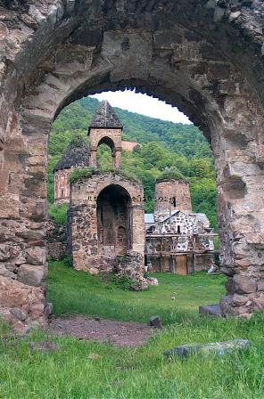
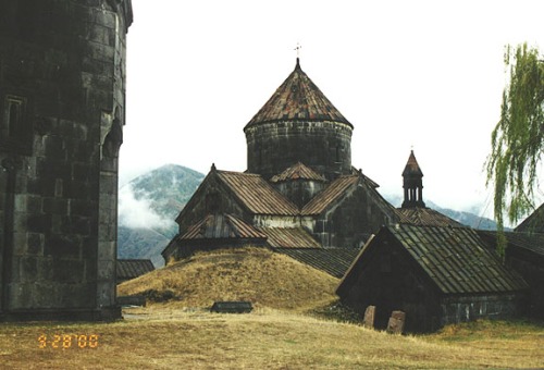
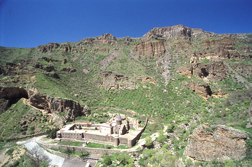
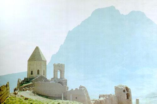
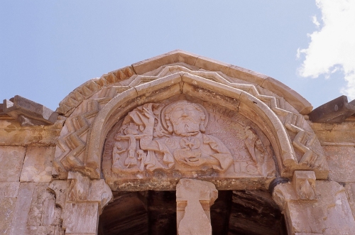
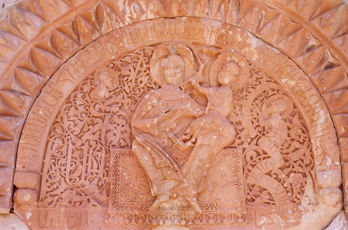
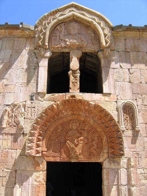
Armenian Churches

Posted by Sjur Cappelen Papazian on May 27, 2020

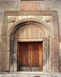
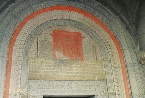
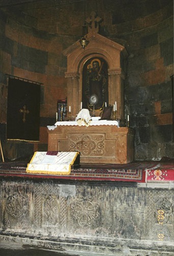
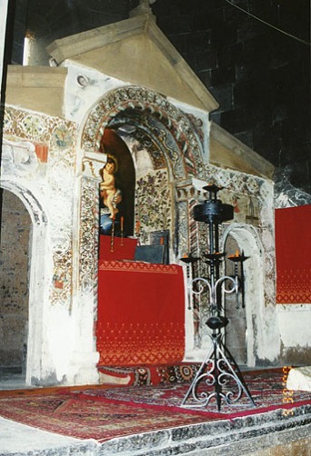
Armenian Churches

Echmiadzin

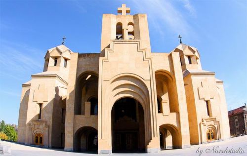
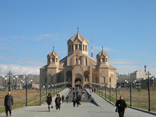
Grigor Lusavorich

Khor Virap

Tatev

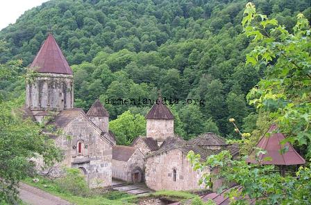
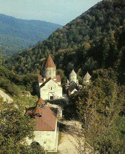
Haghartsin

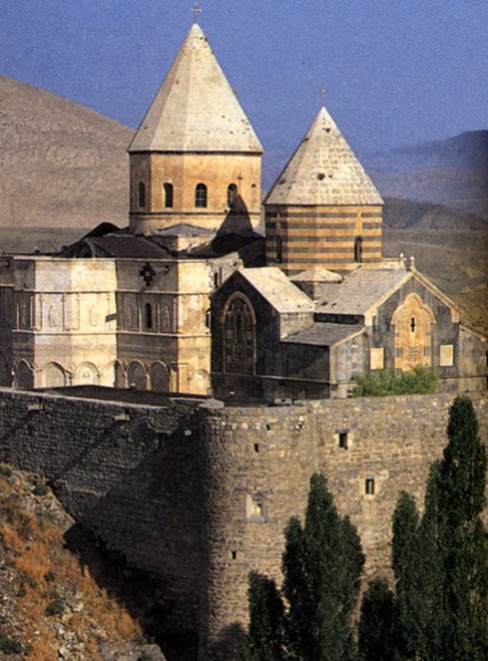
St. Thaddeus

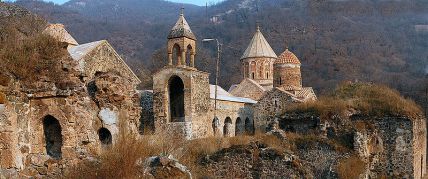
Dadivank

Hagbat

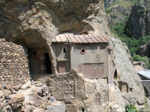
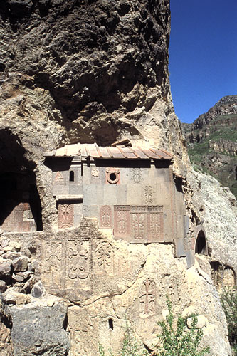
Geghard

Karapet – Noravank

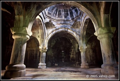
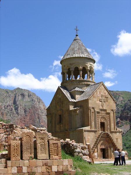
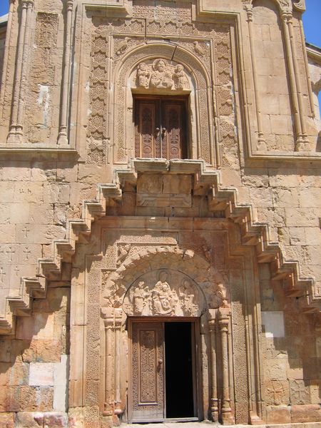
St. Astvatsatsin – Noravank

Ashtarak

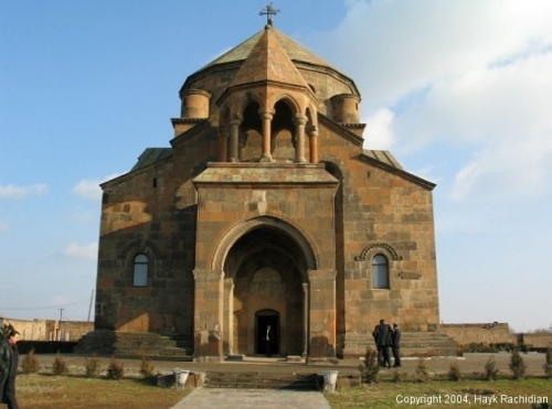
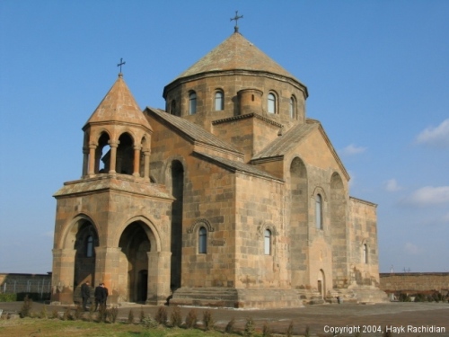
Hripsime

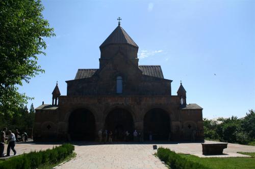
Gayane

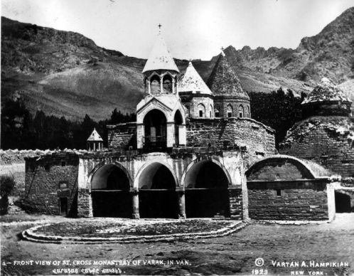
Varak

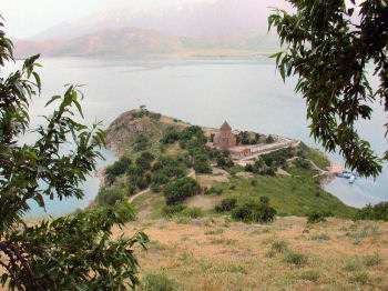
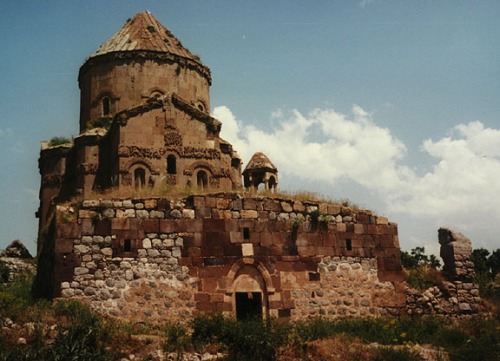
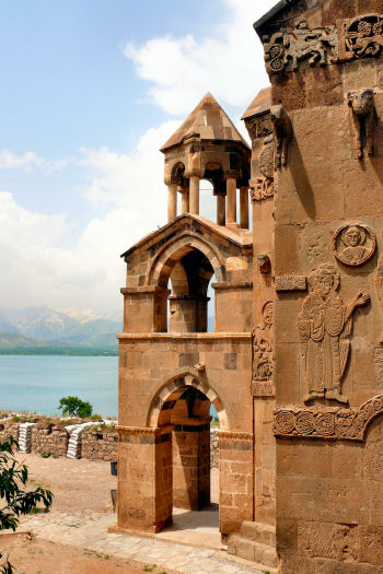
Akdamar

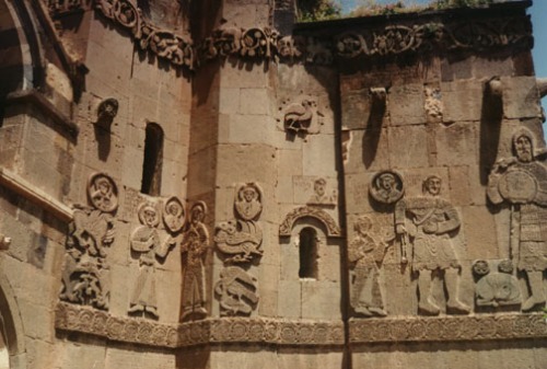
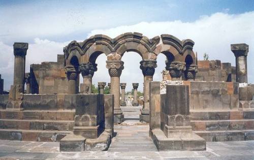
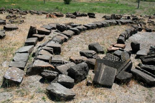
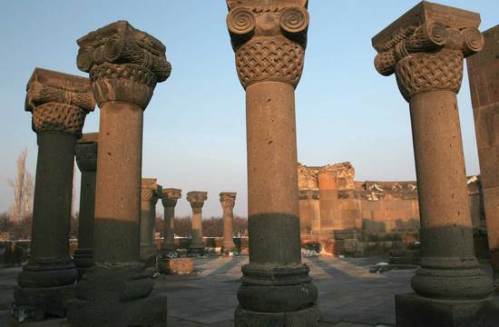
Zvartnots

Holy Trinity Cathedral

Priest

Icons

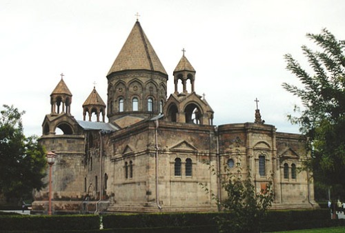
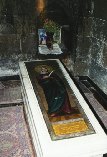
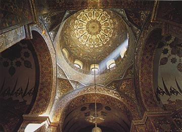
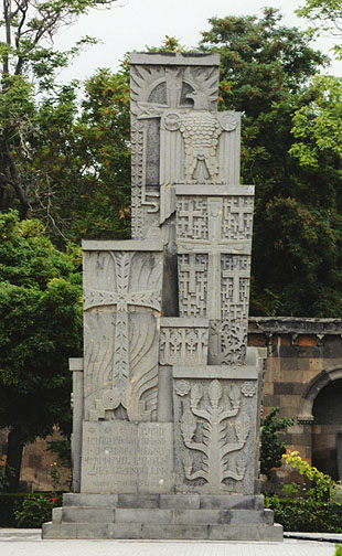
Echmiadzin:

File:Ejmiadzin Cathedral2.jpg

Etchmiadzin Cathedral in Armenia, completed in 303 AD, UNESCO World Heritage Site, religious centre of the world’s oldest Christian state.

zvart4936_Custom

az church-echmiadzin-500

az Echmiadzin

zvart4947_Custom

az Echmiadzin1

az Echmiadzin5

az Echmiadzin3

azArmenia Echmiadzin ceiling

az Echmiadzin2

zvart49_Custom

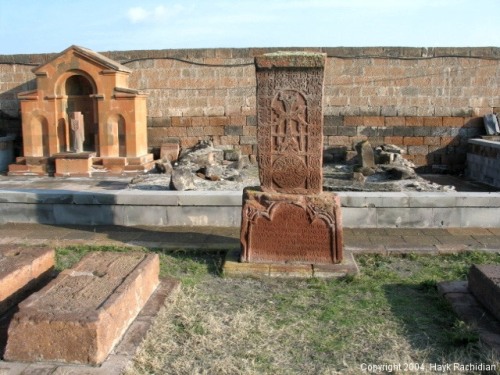
echmiadzin_khachkar_1279

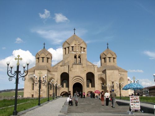
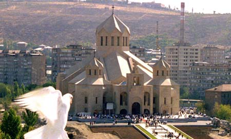
Grigor Lusavorich:

church3

church2917_fa9b11b187

Yerevan_Surb_Grigor

yerevan_grigor_lusavorich

axunik_1

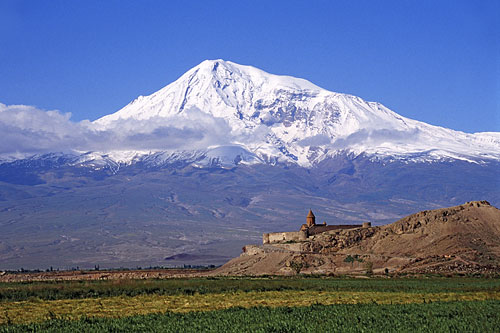
Khor Virap:

az  monastery of Khor Virap

az Khor Virap Monastery

az Khor Virap Monastery2

az Khor Virap Monastery1

az Khor Virap Monastery4

az  monastery of Khor Virap1

az Khor Virap Monasteryæ

Tatev:

Tatev_Monastery,_Armenia

azArmenia_tatev-monastery

tatevm

kirker

Haghartsin:

Haghartsin_1

Haghartsin_monastery-dcp4210

hagartz

haghartsin1

haghartzin 

Haghartsin_6

Haghartsin_10

Haghartsin_snow-dcp8159

madonna

hagart

 St. Thaddeus:

banks Saint Thaddeus MonasteryNorthwestthaddesiran

banksySaint Thaddeus Monastery

banks Saint Thaddeus MonasteryInterieur_qara_kelisa_iran

banks Saint Thaddeus MonasteryDetail_croix_qara_kelisa_iran

Dadivank:

banks Dadivank Monastery, 800px-Dadil

banks Dadivank Monastery,

Dadivank_portal-dcp4095

Hagbat:

az armenia23

az armenia23

az armenia26

az Hagbat armenia24

kirke haghbat

Geghard:

az Armenia_azat_gorge

kirkArmenia (24)

az monastery-geghard-01-500

az monastery-geghard-03-500

az church armenia86

az church armenia88

az church armenia90

az armenia87

az armenia85

Etchmiadzine

az Armenia_Geghard3

az Geghard'3

az Geghard Monastery,

az monastery-geghard-04-500

az Geghard Monastery1

az Geghard'1

az Geghard'1

az gerhard

Karapet – Noravank:

az St. Karapet Monastery

az St. Karapet Church

kara St. Karapet Church

karapet and Child, St Karapet Church

Noravank-Karapet-facade-IMG_2016

St. Astvatsatsin – Noravank:

az Noravank_with_cliffs-DCP_0186

Noravank, Armenia.

Noravank.

norvank

az Noravank

az Noravank-astvatsatsin-IMG_2015

az Noravank 1

az Noravank-astvatsatin-facade-details-IMG_2037

az Noravank-stairs-P5220152

az Haghartsin

noravank

Ashtarak:

az Ashtarak

az Ashtarak5

az Ashtarak1

az Ashtarak2

az Ashtarak3

az Ashtarak6

Hripsime:

hripsime

az Hripsime

az Hripsime1

az Hripsime4

Gayane:

gayane_4919_Custom


gayane

gayane2

gayane4921_Custom

Varak:

az Front View of St Cross Monastery of Varak in Van

Akdamar:

az van1

az 800px-Akhtamar_Island_on_Lake_Van_with_the_Armenian_Cathedral_of_the_Holy_Cross

az van 3

az lAkhtamarake_van06

az van

az van3

az van4

az lAkhtamarake_van05

az lAkhtamarake_van07

az van6

az van 5

Zvartnots:

zvartnots-by_uy

zvartnots

zvartnots7

zvart004_Custom

Zvartnots_img_6967

youarehere..1202494380.zvart-eagle

youarehere..1202494380.zvartnots

youarehere..1202494380.zvartnots-column

zvart_Custom

Holy Trinity Cathedral:

Malatia-Sebastia,_Yerevan,_Armenia

Malatia-Sebastia_district,_Yerevan,_Armenia

Priests:

kirkabc-at-armenia-memorial

katholikos-and-patriarchs

ataturk0C3

kirkabc-at-armenia-memorial

Karekin I Photo0001

archbishop-pargev-martirosyan-nagorno-karabakh

garegin-ii-katholikos-of-all-armenians

https://aratta.files.wordpress.com/2013/01/pic2.jpg?w=277

holy-mass-at-gandzasar-cathedral-nagorno-karabakh-service

Icons:

kirkbartholomew2

armenSt.Gregory.3

ara jesus_christ

kirkStgregoryilluminator

az-dated1232

azniature-minia2

azre-minia1

azure-bible1318matenadaran

kirkArmeniaSacra

azaspurakan1319-1320-1

Posted in Uncategorized | 1 Comment »

The Rosette Symbol

Posted by Sjur Cappelen Papazian on March 12, 2020

A rosette is a round, stylized flower design, used extensively in sculptural objects from antiquity. Appearing in Mesopotamia and used to decorate the funeral stele in Ancient Greece. Adopted later in Romaneseque and Renaissance, and also common in the art of Central Asia, spreading as far as India where it is used as a decorative motif in Greco-Buddhist art.

The rosette derives from the natural shape of a rosette in botany, formed by leaves radiating out from the stem of a plant and visible even after the flowers have withered. The formalised flower motif is often in carved in stone or wood to create decorative ornaments for architecture and furniture. It was a common motif in metalworking, jewelry design and the applied arts at the intersection of two materials, or to form a decorative border.

This motif was widespread throughout Europe and the Near East. Rosette decorations have been used for formal military awards. They are also used to decorate musical instruments, such as around the perimeter of sound holes of guitars.

One of the earliest appearances of the rosette in ancient art is in early fourth millennium BC Mesopotamia. It’s not know for certain what particular symbolism the Sumerians attached to the eight-pointed rosette, but it occurs throughout their cultural history. It can be seen on shell plaques, on the headdresses, and on many other artifacts.

Inanna’s symbol is an eight-pointed star or a rosette. She was associated with lions – even then a symbol of power – and was frequently depicted standing on the backs of two lionesses. Her cuneiform ideogram was a hook-shaped twisted knot of reeds, representing the doorpost of the storehouse (and thus fertility and plenty).

Inanna was associated with the celestial planet Venus. There are hymns to Inanna as her astral manifestation. It also is believed that in many myths about Inanna, including Inanna’s Descent to the Underworld and Inanna and Shukaletuda, her movements correspond with the movements of Venus in the sky.

Also, because of its positioning so close to Earth, Venus moves rather irregularly across the sky, and never travels all the way across the dome of the sky as most celestial bodies do, instead, Venus rises in the East and the West in both the morning and evening.

Because of Venus’ erratic movements (it disappears behind the sun from 90–3 days at a time and then reappears on the other horizon), some cultures did not recognize Venus as single entity, but rather two separate stars on each horizon as the morning and evening star.

The Mesopotamians, however, most likely understood that the planet was one entity. A cylinder seal from the Jemdet Nasr period expresses the knowledge that both morning and evening stars were the same celestial entity.

The erratic movements of Venus relate to both mythology as well as Inanna’s erratic nature. Like Venus, Inanna seems unpredictable in her actions, being both the goddess of love and war, having both masculine and feminine qualities, and occasionally having temper tantrums. However, Mesopotamian literature takes this comparison one step further, explaining Inanna’s physical movements in mythology as similar to the movements of Venus in the sky.

Inanna’s Descent to the Underworld explains how Inanna is able to, unlike any other deity, descend into the netherworld and return to the heavens. The planet Venus appears to make a similar descent, setting in the West and then rising again in the East.

In Inanna and Shukaletuda, in search of her attacker, Inanna makes several movements throughout the myth that correspond with the movements of Venus in the sky. An introductory hymn explains Inanna leaving the heavens and heading for Kur, what could be presumed to be, the mountains, replicating the rising and setting of Inanna to the West. Shukaletuda also is described as scanning the heavens in search of Inanna, possibly to the eastern and western horizons.

Inanna was associated with the eastern fish of the last of the zodiacal constellations, Pisces. Her consort Dumuzi was associated with the contiguous first constellation, Aries.

Seal impressions from the Jemdet Nasr period (ca. 3100–2900 BC) show a fixed sequence of city symbols including those of Ur, Larsa, Zabalam, Urum, Arina, and probably Kesh. It is likely that this list reflects the report of contributions to Inanna at Uruk from cities supporting her cult.

A large number of similar sealings were found from the slightly later Early Dynastic I phase at Ur, in a slightly different order, combined with the rosette symbol of Inanna, that were definitely used for this purpose. They had been used to lock storerooms to preserve materials set aside for her cult. Inanna’s primary temple of worship was the Eanna, located in Uruk (c.f. Worship).

In Egypt the Scorpion macehead (also known as the Major Scorpion macehead) is a decorated ancient Egyptian macehead found by British archeologists James E. Quibell and Frederick W. Green in what they called the main deposit in the temple of Horus at Hierakonpolis during the dig season of 1897/1898.

It is made of limestone, is pear-shaped, and is attributed to the Scorpion II (Ancient Egyptian: possibly Selk or Weha), also known as King Scorpion, referring to the second of two kings or chieftains of that name during the Protodynastic Period of Upper Egypt, due to the glyph of a scorpion engraved close to the image of a king wearing the White Crown of Upper Egypt.

Little is left of this macehead and its imagery: A king wearing the Red Crown of Lower Egypt, sitting on a throne below a canopy, holding a flail. Beside his head, in the upper right corner, there is a image of a scorpion and a rosette. Facing him is a falcon who may be holding an end of a rope in one of its claws – a motif also present on the Narmer Palette.

On the macehead the king sporting a bull’s tail is standing by a body of water, probably a canal, holding a hoe. He is wearing the White Crown of Upper Egypt and is followed by two fan bearers. A scorpion and a rosette are depicted close to his head. He is facing a man holding a basket and men holding standards. A number of men are busy along the banks of the canal. In the rear of the king’s retinue are some plants, a group of women clapping their hands and a small group of people, all of them facing away from the king. In the top register there is a row of nome standards. A bird is dangling from each of them, strung up by its neck.

A second, smaller macehead fragment showing Scorpion wearing the Red Crown of Lower Egypt is referred to as the Minor Scorpion macehead. Little is left of this macehead and its imagery: A king wearing the Red Crown of Lower Egypt, sitting on a throne below a canopy, holding a flail. Beside his head images of a scorpion and a rosette. Facing him is a falcon who may be holding an end of a rope in one of its claws – a motif also present on the Narmer Palette.

It is believed the rosette was a symbol for kingly authority. The origin of this symbolism is unknown. Other of many examples are the famous Narmer palette, also known as the Great Hierakonpolis Palette or the Palette of Narmer, created as a memorial to a victorious campaign by that early king, also carries the rosette motif.

The Narmer Palette is a significant Egyptian archeological find, dating from about the 31st century BC, containing some of the earliest hieroglyphic inscriptions ever found. It is thought by some to depict the unification of Upper and Lower Egypt under the king Narmer.

On one side, the king is depicted with the bulbed White Crown of Upper (southern) Egypt, and the other side depicts the king wearing the level Red Crown of Lower (northern) Egypt.

A large picture in the center of the Palette depicts Narmer wielding a mace wearing the White Crown of Upper Egypt (whose symbol was the flowering lotus). To his left is a man bearing the king’s sandals, once again flanked by a rosette symbol.

Along with the Scorpion Macehead and the Narmer Maceheads, also found together in the Main Deposit at Nekhen, the Narmer Palette provides one of the earliest known depictions of an Egyptian king.

The Palette shows many of the classic conventions of Ancient Egyptian art, which must already have been formalized by the time of the Palette’s creation. The Egyptologist Bob Brier has referred to the Narmer Palette as “the first historical document in the world”.

The Palette, which has survived five millennia in almost perfect condition, was discovered by British archeologists James E. Quibell and Frederick W. Green, in what they called the Main Deposit in the Temple of Horus at Nekhen, during the dig season of 1897–1898. Also found at this dig were the Narmer Macehead and the Scorpion Macehead.

The exact place and circumstances of these finds were not recorded very clearly by Quibell and Green. In fact, Green’s report placed the Palette in a different layer one or two yards away from the deposit, which is considered to be more accurate on the basis of the original excavation notes.

It has been suggested that these objects were royal donations made to the temple. Nekhen, or Hierakonpolis, was the ancient capital of Upper Egypt during the pre-dynastic Naqada III phase of Egyptian history.

Palettes were typically used for grinding cosmetics, but this palette is too large and heavy (and elaborate) to have been created for personal use and was probably a ritual or votive object, specifically made for donation to, or use in, a temple. One theory is that it was used to grind cosmetics to adorn the statues of the gods.

The rosette continued to have a royal symbolism of dignity and authority down into later times. A Hittite tomb stela from the 8th century BC portrays a wonderful example of this symbol hovering over a princess and her attendant. What appears to be a sun-disk contains an eight-pointed rosette with two highly detailed and very bird-like wings stretching out on either side. A light gray steatite Hittite spool seal dating from 1500 BC has a stag on one side and a rosette on the other. The seal is drilled in the center of each.

Another early Mediterranean occurrence of the rosette design derives from Minoan Crete; for example, the rosette design has been found on the famed Phaistos Disc, recovered from the Phaistos archaeological site in southern Crete.

Its purpose and meaning, and even its original geographical place of manufacture, remain disputed, making it one of the most famous mysteries of archaeology. It is made of clay and now is on display at the Archaeological Museum of Herakleion. The exact date of manufacture is uncertain; some archaeologists ascribe it to the 17th century BC.

The Phaistos Disc captured the imagination of amateur and professional archeologists, and many attempts have been made to decipher the code behind the disc’s signs. While it is not clear that it is a script, most attempted decipherments assume that it is; most additionally assume a syllabary, others an alphabet or logography.

Attempts at decipherment are generally thought to be unlikely to succeed unless more examples of the signs are found, as it is generally agreed that there is not enough context available for a meaningful analysis.

The Phaistos disk was found in 1908 in a building at the Minoan palace site of Phaistos, near Hagia Triada, on the south coast of Crete. The disk is 16 centimeters in diameter (or 6 inches, approximately the size of the palm of your hand). It is about 15 cm (5.9 in) in diameter and covered on both sides with a spiral of stamped symbols.

Many, including Benjamin Schwartz, who in his work on decipherment refers to the Phaistos Disc as “the first movable type”, regard it as the first example of printing, since the embedded impressions (figures) were placed there by some form of prepared punch. How such symbolic tools were used otherwise is unknown, since similar examples have never been discovered.

In his popular science book Guns, Germs and Steel, Jared Diamond describes the disc as an example of a technological advancement that did not become widespread because it was made at the wrong time in history, and contrasts this with Gutenberg’s printing press.

The inscription was apparently made by pressing pre-formed hieroglyphic “seals” into the soft clay, in a clockwise sequence spiraling towards the disc’s center. It was then fired at high temperature. The unique character of the Phaistos Disc stems from the fact that the entire text was inscribed in this way, reproducing a body of text with reusable characters.

The German typesetter and linguist Herbert Brekle, in his article “The typographic principle” in the Gutenberg-Jahrbuch, argues that the Phaistos Disc is an early document of movable type printing, since it meets the essential criteria of typographic printing, that of type identity:

An early clear incidence for the realization of the typographic principle is the notorious Phaistos Disc (ca. 1800–1600 BC). If the disc is, as assumed, a textual representation, we are really dealing with a “printed” text, which fulfills all definitional criteria of the typographic principle.

The spiral sequencing of the graphematical units, the fact that they are impressed in a clay disc (blind printing!) and not imprinted are merely possible technological variants of textual representation. The decisive factor is that the material “types” are proven to be repeatedly instantiated on the clay disc.

Eight-petaled rosettes similar to those on the Disk and on the various ancient gameboards appeared also on many other objects. They were generally a symbol for the sun, or more precisely its cycle of birth, death, and rebirth, and so indicated the passages from one state of existence into another.

We might question the origin of the rosette images. Consider an eight-leaf rosette carved through an ivory disk from a child’s burial at the European Gravettian burial site in Sungir, situated about 200 km east of Moscow, on the outskirts of Vladimir, near the Klyazma River in Russia, dated to about 28,000 years ago, the earliest example found up to now, and one of the most beautiful. Clearly the rosette has a very old history, dating back to the times of the Cave Paintings of Europe, and the Great Flood, or earlier.

It was found in a child’s burial at the site, and its funerary context suggests that it may have been associated with the rebirth- and- renewal cluster of ideas already back then.

Whatever this rosette may have meant to its maker, its pierced design evokes to modern eyes the concept of “passage” or “transition” through its central opening even more powerfully than any flat shape could.

Closer to us in time, and less open to doubt about its meaning, are the many ancient Egyptian pictures that show the young sun god being born in a lotus blossom with eight leaves. This image reflects a sunrise over the flooded lands of the Delta where lotus, which grows as the Nile rises, covered the waters to the horizon. It was therefore a fitting sign for that daily rebirth and new beginning.

On the other hand, the association of that flower with birth was not unique to Egypt because in India, various gods, and particularly the Buddha, also emerged into the world from that same eight-petaled lotus.

The Egyptian “Book of the Dead” calls the king of the gods Re in Chapter 15 “the golden youth who came forth from the lotus”, and in Chapter 81 the deceased utters the desire to be transformed into a sacred lotus2.

The typical copy of that book also included a vignette of the cow-headed sky-goddess Hathor, the “mother of light”, emerging from the burial mound with an eight-leaved rosette on her neck.  Right next to her, the tomb owner rises from his coffin and clutches two “Life” signs in his hands, leaving no doubt about the meaning of the scene.

Similarly, a painted portrait from Tutankhamun’s tomb shows him rising out of a lotus blossom with eight petals that grows from his coffin and so illustrates his resurrection.

Such images led the symbolist Manfred Lurker to propose in his illustrated Dictionary “The Gods and Symbols of Ancient Egypt” that the rosette represented the sun breaking forth after the night and the defeat of the abysmal darkness.

The Bronze Age Cretans, too, decorated many objects with eight-leaved rosettes, including the ceiling of the “Throne Room” in the palace at Knossos. Like the later Philistines and Canaanites, they used that rosette as one of their favorite pottery ornaments.

The presence of golden eight-leaf rosettes in tombs at Mochlos, Crete, from around 2,000 BCE, and in Mycenaean graves from more than half a millennium later, attests that in these cultures, too, this sign was associated with a symbolism of death to be followed by rebirth.

Some of the wigs on the human-shaped clay coffins from Philistine-occupied Beth-Shean bear lotus flowers, and the sarcophagus of king Ahiram from the Phoenician city of Byblos, dated to about the time of Solomon, displays a ceremonial scene common in Phoenician art which shows him holding a lotus flower as a sign of his rebirth and apotheosis.

The Classical Greeks were equally fond of the eight-leaved rosette motif. One particularly revealing stone sculpture at the former site of the Eleusinian mystery cult shows an initiate emerging from the center of a giant eight-petaled flower bud that is marked all over with eight-leaf rosettes. The context leaves here no doubt that this sculpture illustrated the spiritual rebirth which the initiate to those mysteries was said to achieve7.

In the sun cults of ancient Northern Europe, a wheel with eight spokes represented the sun and its regenerative powers but appeared also as a symbol of death and destruction.

Similarly, the symbolic meaning of the Near Eastern rosette included death, as on a fragment from the throne of pharaoh Thutmosis IV where that sign marks an enemy crushed by the king’s foot.

On Greek vase paintings of battles, or of Theseus killing the Minotaur, an eight-leaf rosette often conveyed that the combat ended in death. For instance, a vase painting from about 660 BCE shows a clash between the warriors on two ships. Where their spears meet over the opposing bows, the ancient painter placed the eight-leaf rosette the way a modern comic book artist would put there a graphically enhanced “Zap” or “Pow”.

In Minotaur-slaying scenes, the rosette marks sometimes that monster to announce its upcoming death. At other times, it decorates Theseus and can be seen as a sign that he will return from his excursion into the labyrinth, a symbol of the underworld, and will thereby be regenerated.

In India, and in a few cases also in ancient Mesopotamia, an eight- leaf rosette adorned the memorial stelae of widow- burning victims who had been killed in their husbands’ funeral pyres.

In general, the contexts in which we find the eight-leaf rosette suggest that it represented the birth, death, and rebirth of the sun (and/or of the planet Venus), in many of the ancient Near Eastern religions which could have influenced the maker of the Disk.

This direction-reversing track on each side of the Disk resembles the paths on a group of gameboards for race games from India. These also begin with a counterclockwise tour around the border of their board and then make a U-turn to spiral clockwise to the center.

A geographical distance like that between India and Crete does not rule out the possibility of faraway connections through which people far from each other often shared common symbols or their expressions such as, for instance, this unique and characteristic game path of a counterclockwise outer turn followed by a clockwise spiral inward.

India was an active part of the same cultural complex that produced the civilizations of the Fertile Crescent and their many common basic beliefs. The people of the Indus Valley, or Harappan, civilization shared a common cultural matrix with the Cretans and many other peoples of their time. That matrix included, for instance, bull cults and snake worship which are both attested in both India and Crete and in some of the areas between them.

In addition, both emphasized maritime trade since Crete is an island, and practically all the Harappan cities were built on the seashore or on navigable rivers. The ruins of Harappa and of Knossos also happened to reveal some of the most advanced sanitary plumbing systems of their time.

There can be no doubt about the existence of ancient trading contacts between Bronze Age Crete and Harappan India, however indirect these may have been through middlemen from Mari or elsewhere. Sir Mortimer Wheeler, who excavated many of the principal Indus Valley sites, points out that two segmented faience beads, one from Knossos and the other from Harappa, did not only have the same shape but were also identical in composition, as shown by spectrographic analysis25.

Despite the miles and mountains that separated those civilizations, many of their beliefs spread also among them. For instance, Indian Vedic gods such as Mitra, Varuna, and Indra witnessed the oaths of kings in Hurrian Mitanni which is now in Syria. Also, most of the Hurrian words for horse craft were derived from Sanskrit, a major language of ancient India.

Moreover, in Ugarit on the Syrian coast, one of the words for “fire” was the name of Agni, the Indian Vedic god of fire who led to Latin “ignis” and so provided English speakers with “ignition” as well as the cozy “inglenook” by the fireplace.

As another example of such wide diffusion for certain ideas, the Classical Labyrinth design with seven circuits is first attested in the above doodle on the back of a book-keeping tablet from Pylos in Greece, dated to about 1200 BCE.

This labyrinth was also strongly associated with nearby Crete where it appeared in both round and square forms on coins from about the sixth century BCE on. However, that same intricate and unmistakable design is also reported from early southern India, among many other times and places.

Similarly, board games travel easily and spread widely, like most other number-related traditions, and they are often found distributed in almost identical form over large regions or in widely separated areas.

An excellent example is the ancient game of “Five Lines” which is still played in Crete and, of all other places, also in Northern India. A board for this game, shaped like a five-pointed star, was also found chiseled into the roofing slabs of a temple at Kurna in Egypt, completed during the 14th century BCE.

It takes therefore no stretch of the imagination to suspect  possible relationships between board games played in distant areas of the same cultural complex, particularly if these share an otherwise unusual trait such as that U-turn after the first counterclockwise go-around.

Graves 1 and 2 at Sunghir are described as “the most spectacular” among burials. The adult male was buried in what is called Grave 1 and the two adolescent children in Grave 2, placed head to head, together with an adult femur filled with red ochre.

The settlement area was found to have four burials: the remains of an older man and two adolescent children are particularly well-preserved, and the nature of the rich and extensive burial goods suggests they belonged to the same class. In addition, a skull and two fragments of human femur were also found at the settlement area, and two human skeletons outside the settlement area without cultural remains.

The three individuals buried at Sungir were all adorned with elaborate grave goods that included ivory-beaded jewelry, clothing, and spears. More than 13,000 beads were found (which would have taken 10,000 hours to produce). Red ochre, an important ritual material associated with burials at this time, covered the burials.

The children are considered a twin burial, thought to have ritual purpose, likely sacrifice. The findings of such complete skeletons are rare in late Stone Age, and indicate the high status of the male adult and related children. The children had the same MtDNA, which may indicate the same maternal lineage, but more would need to be known about other individuals in the settlement.

The site is one of the earliest examples of ritual burials and constitutes important evidence of the antiquity of human religious practices. The extraordinary collection of grave goods, the position of the bodies, and other factors all indicate it was a burial of high importance. Two other remains at the site are partial skeletons.

The remains are held by the Institute of Ethnology and Anthropology of RAS, Moscow. In 2004, the International Seminar, “Upper Paleolithic People from Sunghir, Russia,” was hosted by the Department of Archaeology, University of Durham, UK. It is the second of two major conferences about this site.

Two books have been published in Moscow about the findings. Upper Palaeolithic Site Sungir (graves and environment) (1998) was the first complete publication about the site, including an inventory of artifacts, reconstruction of the Paleolithic man’s clothes, archaic counting and calendar. The second part of the book displays the reconstruction of the environment by geological, palinological, zoological data.

The second book, Homo Sungirensis (2000) edited by T.I. Aexeeva et al., includes articles published since the first book, and new anthropological data derived from morphology, palaeopathology, X-ray study, histology, trace elements and molecular genetic analyses. It has an illustrated catalogue of all the skeletal materials.

Posted in Uncategorized | Leave a Comment »

Concerning the Western Steppe Herder (WSH)

Posted by Sjur Cappelen Papazian on February 21, 2020

Western Steppe Herders – Wikipedia

Armenians is the original people in the Armenian Highland. Armenians traditionally lived not only on the territory of the modern nation of Armenia, which today is known as Eastern Armenia, but also in Western Armenia, which today is Eastern Turkey. Armenian language is part of the great Indo-European family of languages.

Armenian men’s most common Y-DNA (paternal) haplogroup is R1b, found in about 28 percent of those studied. J2 is the next most common at a frequency of 22 percent. Other haplogroups found among them, in descending order of frequencies, include G (11%), J1 (11%), R1a (8%), T (6%), E (5%), I (4%), L (4%), N (2%), and others (1%).

Nomadic pastoralism is a form of pastoralism when livestock are herded in order to find fresh pastures on which to graze. The herded livestock include cows, buffalos, yaks, llamas, sheep, goats, reindeer, horses, donkeys or camels, or mixtures of species.

Nomadic pastoralism was a result of the Neolithic revolution and the rise of agriculture. During that revolution, humans began domesticating animals and plants for food and started forming cities.

Nomadism generally has existed in symbiosis with such settled cultures trading animal products (meat, hides, wool, cheese and other animal products) for manufactured items not produced by the nomadic herders.

In the past it was asserted that pastoral nomads left no presence archaeologically or were impoverished, but this has now been challenged, and was clearly not so for many ancient Eurasian nomads, who have left very rich kurgan burial sites.

Pastoral nomadic sites are identified based on their location outside the zone of agriculture, the absence of grains or grain-processing equipment, limited and characteristic architecture, a predominance of sheep and goat bones, and by ethnographic analogy to modern pastoral nomadic peoples.

It has been hypothetised that R1b people (perhaps alongside neighbouring J2 tribes) were the first to domesticate cattle in northern Mesopotamia some 10,500 years ago. R1b tribes descended from mammoth hunters, and when mammoths went extinct, they started hunting other large game such as bisons and aurochs.

With the increase of the human population in the Fertile Crescent from the beginning of the Neolithic (starting 12,000 years ago), selective hunting and culling of herds started replacing indiscriminate killing of wild animals. The increased involvement of humans in the life of aurochs, wild boars and goats led to their progressive taming.

Cattle herders probably maintained a nomadic or semi-nomadic existence, while other people in the Fertile Crescent (presumably represented by haplogroups E1b1b, G and T) settled down to cultivate the land or keep smaller domesticates.

The development of early cereal agriculture is thought to have been conducted by men belonging primarily to haplogroups G2a (northern branch, from Anatolia to Europe), as well as E1b1b and T1a (southern branch, from the Levant to the Arabian peninsula and North Africa).

The analysis of bovine DNA has revealed that all the taurine cattle (Bos taurus) alive today descend from a population of only 80 aurochs. The earliest evidence of cattle domestication dates from circa 8,500 BCE in the Pre-Pottery Neolithic cultures in the Taurus Mountains.

The two oldest archaeological sites showing signs of cattle domestication are the villages of Çayönü Tepesi in southeastern Turkey and Dja’de el-Mughara in northern Iraq, two sites only 250 km away from each others. This is presumably the area from which R1b lineages started expanding – or in other words the “original homeland” of R1b.

The early R1b cattle herders would have split in at least three groups. One branch (M335) remained in the Armenian Highland, but judging from its extreme rarity today wasn’t very successful, perhaps due to the heavy competition with other Neolithic populations in the area, or to the scarcity of pastures in this mountainous environment.

Bull Worship

Haplogroup J2 is thought to have appeared somewhere in the Middle East towards the end of the last glaciation, between 15,000 and 22,000 years ago. The oldest known J2a samples at present were identified in remains from the Hotu Cave in northern Iran, dating from 9100-8600 BCE, and from Kotias Klde in Georgia, dating from 7940-7600 BCE.

This confirms that haplogroup J2 was already found around the Caucasus and the southern Caspian region during the Mesolithic period. The first appearance of J2 during the Neolithic came in the form of a 10,000 year-old J2b sample from Tepe Abdul Hosein in north-western Iran in what was then the Pre-Pottery Neolithic.

Notwithstanding its strong presence in West Asia today, haplogroup J2 does not seem to have been one of the principal lineages associated with the rise and diffusion of cereal farming from the Fertile Crescent and Anatolia to Europe.

It is likely that J2 men had settled over most of Anatolia, the South Caucasus and Iran by the end of the Last Glaciation 12,000 years ago. It is possible that J2 hunter-gatherers then goat/sheep herders also lived in the Fertile Crescent during the Neolithic period.

No Neolithic sample from Central or South Asia has been tested to date, but the present geographic distribution of haplogroup J2 suggests that it could initially have dispersed during the Neolithic from the Zagros mountains and northern Mesopotamia across the Iranian plateau to South Asia and Central Asia, and across the Caucasus to Russia (Volga-Ural).

The first expansion probably correlated with the diffusion of domesticated of cattle and goats (starting c. 8000-9000 BCE), rather than with the development of cereal agriculture in the Levant. A second expansion would have occured with the advent of metallurgy.

J2 could have been the main paternal lineage of the Kura-Araxes culture (Late Copper to Early Bronze Age), which expanded from the southern Caucasus toward northern Mesopotamia and the Levant. After that J2 could have propagated through Anatolia and the Eastern Mediterranean with the rise of early civilizations during the Late Bronze Age and the Early Iron Age.

Quite a few ancient Mediterranean and Middle Eastern civilisations flourished in territories where J2 lineages were preponderant. This is the case of the Hattians, the Hurrians, the Etruscans, the Minoans, the Greeks, the Phoenicians (and their Carthaginian offshoot), the Israelites, and to a lower extent also the Romans, the Assyrians and the Persians. All the great seafaring civilisations from the middle Bronze Age to the Iron Age were dominated by J2 men.

There is a distinct association of ancient J2 civilisations with bull worship. The oldest evidence of a cult of the bull can be traced back to Neolithic central Anatolia, notably at the sites of Çatalhöyük and Alaca Höyük.

Bull depictions are omnipresent in Minoan frescos and ceramics in Crete. Bull-masked terracotta figurines and bull-horned stone altars have been found in Cyprus (dating back as far as the Neolithic, the first presumed expansion of J2 from West Asia).

The Hattians, Sumerians, Babylonians, Canaaites, and Carthaginians all had bull deities (in contrast with Indo-European or East Asian religions). The sacred bull of Hinduism, Nandi, present in all temples dedicated to Shiva or Parvati, does not have an Indo-European origin, but can be traced back to Indus Valley civilisation.

Minoan Crete, Hittite Anatolia, the Levant, Bactria and the Indus Valley also shared a tradition of bull leaping, the ritual of dodging the charge of a bull. It survives today in the traditional bullfighting of Andalusia in Spain and Provence in France, two regions with a high percentage of J2 lineages.

Levant and North Africa

A second branch of R1b migrated south to the Levant, where it became the V88 branch. Some of them searched for new lands south in Africa, first in Egypt, then colonising most of northern Africa, from the Mediterranean coast to the Sahel.

Like its northern counterpart (R1b-M269), R1b-V88 is associated with the domestication of cattle in northern Mesopotamia. Both branches of R1b probably split soon after cattle were domesticated, approximately 10,500 years ago (8,500 BCE).

R1b-V88 migrated south towards the Levant and Egypt. The migration of R1b people can be followed archeologically through the presence of domesticated cattle, which appear in central Syria around 8,000-7,500 BCE (late Mureybet period), then in the Southern Levant and Egypt around 7,000-6,500 BCE (e.g. at Nabta Playa and Bir Kiseiba).

Cattle herders subsequently spread across most of northern and eastern Africa. The Sahara desert would have been more humid during the Neolithic Subpluvial period (c. 7250-3250 BCE), and would have been a vast savannah full of grass, an ideal environment for cattle herding.

A warm and humid monsoon climate prevailed in North Africa at the beginning of the Holocene, favourable to savannah with numerous lakes. The cooling and decreasing of African monsoons at 6200 BC caused dry climatic conditions. Some authors suggest that this periodwas a key point in the development of cattle pastoralism in the Sahara.

Increased aridity is believedto have played a key role in encouraging the integra-tion of cattle herding with existing hunting and for-aging systems. The ex-ploitation of mountain pastures for goat and sheepgrazing (possibly developed first in western Asia)was a result of drier conditions in the foothills ofLibya.

In this period, the dispersal and isolation ofdifferent cultural groups occurred all across the Sa-hara. These groups migrated to unknown territoriesin search of water and pastures. Subsequently, settle-ments grew up around water basins.

The earliest settlements in the southern part of Egyptconsisted of small groups engaged in cattle husbandry and pottery making. The 6200 BC climate event resulted in economicdevelopments such as the appearance of small cat-tle and the growth of settlements with numerous fireplaces near large water basins.

Pre-Pottery Neolithic B (PPNB)

Haplogroup G formed approximately 50,000 years ago as a side lineage of haplogroup IJK, but seems to have had a slow start, evolving in isolation for tens of thousands of years, possibly in the Near East, cut off from the wave of colonisation of Eurasia.

The highest genetic diversity within haplogroup G is found in the northern part of the Fertile Crescent, between the Levant and the Caucasus, which is a good indicator of its region of origin. So far, the only G2a people negative for subclades downstream of P15 or L149.1 were found exclusively in the South Caucasus region.

As of late 2016, there were 303 mutations (SNPs) defining haplogroup G, confirming that this paternal lineage experienced a severe bottleneck before splitting into haplogroups G1 and G2. G1 might have originated around modern Iran at the start of the Last Glacial Maximum (LGM), some 26,000 years ago.

G2 would have developed around the same time in West Asia. At that time humans would all have been hunter-gatherers, and in most cases living in small nomadic or semi-nomadic tribes. Members of haplogroup G2 appear to have been closely linked to the development of early agriculture in the Fertile Crescent part, starting 11,500 years before present.

The G2a branch expanded to Anatolia, the Caucasus and Europe, while G2b diffused from Iran across the Fertile Crescent and east to Pakistan. It is now found mostly among Lebanese and Jewish people, but also at low frequency in the Arabian peninsula, Syria, Iraq, Iran, Afghanistan and Pakistan.

It is thought that early Neolithic farmers expanded from northern Mesopotamia westwards to Anatolia and Europe, eastwards to South Asia, and southwards to the Arabian peninsula and North and East Africa.

The testing of Neolithic remains in various parts of Europe has confirmed that haplogroup G2a was the dominant lineages of Neolithic farmers and herders who migrated from Anatolia to Europe between 9,000 and 6,000 years ago.

Pre-Pottery Neolithic B (PPNB) is part of the Pre-Pottery Neolithic, a Neolithic culture centered in upper Mesopotamia, dating to c. 8800 – 6500 BCE. It was typed by Kathleen Kenyon during her archaeological excavations at Jericho in the West Bank.

Like the earlier Pre-Pottery Neolithic A (PPNA) people, the PPNB culture developed from the Mesolithic Natufian culture. However, it shows evidence of a northerly origin, possibly indicating an influx from the Armenian Highland.

Cultural tendencies of this period differ from that of the earlier PPNA period in that people living during this period began to depend more heavily upon domesticated animals to supplement their earlier mixed agrarian and hunter-gatherer diet.

This is the first period in which architectural styles of the southern Levant became primarily rectilinear; earlier typical dwellings were circular, elliptical and occasionally even octagonal.

Pyrotechnology was highly developed in this period. During this period, one of the main features of houses is a thick layer of white clay plaster flooring, highly polished and made of lime produced from limestone. It is believed that the use of clay plaster for floor and wall coverings during PPNB led to the discovery of pottery.

The earliest proto-pottery was White Ware vessels, made from lime and gray ash, built up around baskets before firing, for several centuries around 7000 BCE at sites such as Tell Neba’a Faour (Beqaa Valley).

Sites from this period found in the Levant utilizing rectangular floor plans and plastered floor techniques were found at Ain Ghazal, Yiftahel (western Galilee), and Abu Hureyra (Upper Euphrates). The period is dated to between c. 8700 and c. 6000 BCE.

Plastered human skulls were reconstructed human skulls that were made in the ancient Levant between 9000 and 6000 BC in the Pre-Pottery Neolithic B period. The skulls denote some of the earliest sculptural examples of portraiture in the history of art. They represent some of the oldest forms of art in the Middle East and demonstrate that the prehistoric population took great care in burying their ancestors below their homes.

Tell Aswad (“Black hill”; c. 8700 – 7500 BC), Su-uk-su or Shuksa, was a large fully established PPNB agricultural village, about 5 hectares (540,000 sq ft) in size, located around 48 kilometres (30 mi) from Damascus in Syria, on a tributary of the Barada River at the eastern end of the village of Jdeidet el Khass.

It was earlier suggested a PPNA Aswadian culture, but this has not been validated. Instead, it has been found evidence of a PPNB culture at 8700 BC, pushing back the period’s generally accepted start date by 1,200 years. Similar sites to Tell Aswad in the Damascus Basin of the same age were found at Tell Ramad and Tell Ghoraifé.

The redating of the earliest levels of Tell Aswad to the early PPNB place it alongside other sites with domesticated cereals such as Cafer Hüyük and Aşıklı Höyük (Turkey), Ganj Dareh and Chogah Golan (Iran), and Wadi el-Jilat 7 and Ain Ghazal (Jordan).

Tell Aswad can now be seen as part of a pattern of multi-regional, dispersed local development in at least five areas of the Near East, rather than as uniquely early evidence pointing to agricultural origins in the southern Levant.

Radiocarbon dating of the new excavations, and of seeds from the 1970s excavations, documents occupation in the Pre-Pottery Neolithic B (PPNB) period, split into three parts; Early PPNB from 8700 to 8200 BC and the Middle PPNB from 8200 to 7500 BC. Late PPNB has been equated with Dunand’s “Néolithique ancien de Byblos”.

Tell Aswad has been cited as being of importance for the evolution of organised cities due to the appearance of building materials, organized plans and collective work. It has provided insight into the “explosion of knowledge” in the northern Levant during the PPNB Neolithic stage following dam construction.

Despite the (apparently) early date of domesticated plants, Aswad is not considered the center for the origin of agriculture. Its first inhabitants might have arrived, perhaps from the neighboring Anti-Lebanon, already equipped with the seeds for planting. Thus it was not in the oasis itself that they carried out their first experiments in farming.

A large number of goats were evident in the early stages indicating they were either hunted or herded. This is an important issue because the period when animal domestication first took place is still an open question. From the middle PPNB, the presence of corralled animals is evident.

There are pigs, sheep, goats and cattle. For the latter two, production of meat and milk has been noted. In addition, cattle often show diseases resulting from their use for labour. The image that results from the study of the archaeozoological evidence is a village of farmers and herders in full possession of food production techniques.

How a PPNB culture could spring up in this location, practicing domesticated farming from 8700 BC has been the subject of speculation. Whether it created its own culture or imported traditions from the North East or Southern Levant has been considered an important question for a site that poses a problem for the scientific community.

In the desertic and semi-desertic regions of the Negev and the Sinai Epipalaeolithic industries (e.g. Kebaran, Mushabian, Harifian) point to favourable climatic conditions that permitted the exploitation of a range of desertic ecozones by groups of hunter-gatherers. This period was followed by an apparent local hiatus in occupationduring the Pre-Pottery Neolithic A (ca. 9600-8500 BC).

During this lapse of time the Negev and Sinai were, with only a few exceptions such as the small “epi-Harifian” encampment at Abu Madi I in the high mountains of the southern Sinai, virtually devoid of occupants, indicating a verylimited use of arid areas by, hypothetically, highly mobile foragers (residual Harifian communities).

A gradual re-colonization of the region or a local increase emanating from vestigial local populations is demonstrated during the course of the Pre-Pottery Neolithic B, especially during the Middle (ca. 8100-7500 BC) and Late PPNB (ca. 7500-6750 BC). Small-scale mobile foraging groups exploited both the highlands and lowlands, probably on a seasonal basis

The Middle PPNB period represented a major transformation in prehistoric lifeways from small bands of mobile hunter–gatherers to large settled farming and herding villages in the Mediterranean zone in the Levant, a process having been initiated some 2000–3000 years earlier.

Ayn Ghazal

Ayn Ghazal is a Neolithic archaeological site located in metropolitan Amman, Jordan, about 2 km north-west of Amman Civil Airport. The settlement at ‘Ain Ghazal (“Spring of the Gazelle”) first appeared in the MPPNB and is split into two phases. Phase I starts circa 8,300 BC and ends c. 7,950 BC, while phase II ends c. 7,550 BC.

In its prime era circa 7000 BC, the site extended over 10–15 hectares (25–37 ac) and was inhabited by ca. 3000 people (four to five times the population of contemporary Jericho). After 6500 BC, however, the population dropped sharply to about one sixth within only a few generations, probably due to environmental degradation, the 8.2 kilo-year event.

Y-DNA haplogroup E1b1b1b2 has been found in 75% of the ‘Ain Ghazal population, along with 60% of PPNB populations (and is present in all three stages of PPNB) and in most Natufians. T1a (T-M70) is found among the later Middle Pre-Pottery Neolithic B (MPPNB) inhabitants from ‘Ain Ghazal, but was not found among the early and middle MPPNB populations. 

It is thought, therefore, that the Pre-Pottery Neolithic B population is mostly composed of two different populations: members of early Natufian civilisation and a population resulting from immigration from the north, i.e. north-eastern Anatolia. It is hypothesized that T1* (if not some of its subclades) spread into Europe and North Africa with the Pre-Pottery Neolithic B culture (PPNB).

Haplogroup T emerged from haplogroup K, the ancestor of most of the Eurasian haplogroups (L, N, O, P, Q, R and T), some time between 45,000 and 35,000 years ago. The vast majority of modern members of haplogroup T belong to the T1a branch, which developed during the late glacial period, between 25,000 and 15,000 years ago, possibily in the vicinity of the Iranian Plateau.

Although haplogroup T is more common today in East Africa than anywhere else, it almost certainly spread from the Fertile Crescent with the rise of agriculture. Indeed, the oldest subclades and the greatest diversity of T is found in the Middle East, especially around the Fertile Crescent.

By the end of the last glacial period, 12,000 years ago, haplogroup T had already differentiated into subclades such as T1a1a, T1a2, T1a3a and T1a3b. Deeper subclades developed in the Near East during the Early Neolithic period for several millennia before early farmers started expanding beyond the Near East.

Although haplogroup T is more common today in East Africa than anywhere else, it almost certainly spread from the Fertile Crescent with the rise of agriculture. Indeed, the oldest subclades and the greatest diversity of T is found in the Middle East, especially around the Fertile Crescent.

One theory is that haplogroup T spread alongside J1 as herder-hunters in the Pre-Pottery Neolithic period, leaving the Zagros mountains between 9,000 and 10,000 BCE, reaching the Egypt and the southern Arabian peninsula around 7,000 BCE, then propagating from there to the Horn of Africa, and later on to Madagascar.

However, considering that J1 peaks in Yemen and Sudan, while T1 is most common in southern Egypt, Eritrea and Somalia, the two may not necessarily have spread together. They might instead have spread as separate nomadic tribes of herders who colonised the Red Sea region during the Neolithic, a period than spanned over several millennia.

Nevertheless both are found in all the Arabian peninsula, all the way from Egypt to Somalia, and in Madagascar. This contrasts with other Near Eastern haplogroups like G2a and J2, which are conspicuously absent from East Africa, and rare in the Arabian peninsula.

Nowadays, T1a subclades dating from the Neolithic found in East Africa include Y16247 (downstream of CTS2214) and Y16897. Other subclades dating from the Bronze Age (see below) are present as well, such as Y15711 and Y21004, both downstream of CTS2214.

The Pastoralists

Henri Fleisch tentatively suggested the Shepherd Neolithic industry of Lebanon may date to the Epipaleolithic and that it may have been used by one of the first cultures of nomadic shepherds in the Beqaa valley.

Andrew Sherratt demonstrates that “early farming populations used livestock mainly for meat, and that other applications were explored as agriculturalists adapted to new conditions, especially in the semi‐arid zone.”

The first J1 men lived in the Late Upper Paleolithic, shortly before the end of the last Ice Age. The oldest identified J1 sample to date comes from Satsurblia cave (c. 13200 BCE) in Georgia, placing the origins of haplogroup J1 in all likelihood in the region around the Caucasus, Zagros, Taurus and eastern Anatolia during the Upper Paleolithic.

Like many other successful lineages from the Middle East, J1 is thought to have undergone a major population expansion during the Neolithic period. The greatest genetic diversity of J1 haplotypes was found in eastern Anatolia, near Lake Van in central Kurdistan.

Eastern Anatolia and the Zagros mountains are the region where goats and sheep were first domesticated, some 11,000 years ago. J1-P58 started expanding 9,000 to 10,000 years ago as pastoralists from the Fertile Crescent. Although they did not analyze the other branches, it is likely that all surviving J1a1b (L136) lineages share the same origin as goat and sheep herders from the Taurus and Zagros mountains.

The mountainous terrain of the Caucasus, Anatolia and modern Iran, which wasn’t suitable for early cereal farming, was an ideal ground for goat and sheep herding and catalyzed the propagation of J1 pastoralists.

Having colonised most of Anatolia, J1 herders would have settled the mountainous regions of Europe, including the southern Balkans, the Carpathians, central and southern Italy (Apennines, Sicily, Sardinia), southern France (especially Auvergne), and most of the Iberian peninsula. Hotspots of J1 in northern Spain (Cantabria, Asturias) appear to be essentially lineages descended from these Southwest Asian Neolithic herders.

Most J1 Europeans belong to the J1-Z1828 branch, which is also found in Anatolia and the Caucasus, but not in Arabic countries. The Z1842 subclade of Z1828 is the most common variety of J1 in Armenia and Georgia. There are also two other minor European branches: J1-Z2223, which has been found in Anatolia and Western Europe, and J1-M365.1, also found a bit everywhere across Western Europe.

Their very upstream position in the phylogenetic tree and their scarcity in the Middle East suggests that these were among the earliest J1 lineages to leave the Middle East, perhaps as Late Paleolithic or Mesolithic hunter-gatherers that wandered outside Anatolia and, pushed by successive waves of migrations from the Neolithic to the Bronze Age, ended up in Western Europe.

Within the Middle East, SNP analysis shows that the J1-L136 branch migrated south from eastern Anatolia and split in four directions: Anatolia/Europe (PF7263), the Levant, the southern Zagros (and southern Mesopotamia ?), and the mountainous south-western corner of the Arabian peninsula (mostly in Yemen), bypassing the Arabian Desert.

That latter group, consisting essentially of J1-P56 lineages, crossed the Red Sea to settle Sudan, Eritrea, Djibouti and northern Somalia. The climate would have been considerably less arid than today during the Neolithic period, allowing for a relatively easy transmigration across the Middle East with herds of goats.

Neolithic J1 goat herders were almost certainly not homogenous tribes consisting exclusively of J1 lineages, but in all likelihood a blend of J1 and  T1 lineages. So much is evident from the presence of both J1 and T1 in north-east Africa, Yemen, Saudi Arabia, but also in the Fertile Crescent, the Caucasus and the mountainous parts of southern Europe. Maternal lineages also correlate.

Wherever J1 and T1 are found in high frequency, mtDNA haplogroups HV, N1 and U3 are also present, as well as J, K and T to a lower extent. It is unclear whether goats were domesticated by a tribe that already comprised both J1 and T1 lineages, or if the merger between the two groups happened during the Neolithic expansion, when two separate tribes would have bumped into each others, intermixed, and thereafter propagated together.

End of PPNB

The PPNB culture disappeared during the 8.2 kiloyear event, a term that climatologists have adopted for a sudden decrease in global temperatures that occurred approximately 8,200 years before the present, or c. 6200 BCE, and which lasted for the next two to four centuries, although PPNB culture continued in the Amuq valley, where it influenced the later development of the Ghassulian culture.

The influence of the event in Europe was greatest in Central Anatolia. The flourishing and well-established settlement at Catalhöyük-East was deserted quite abruptly. The site was reoccupied later, with a shift of the settlement by approx. 200m to a new position (Çatalhöyük-West). This settlement shift marks the beginning ofthe Early Chalcolithic in Central Anatolia.

The climate event was associated with the transition from the Pre-Pottery to the Pottery Neolithic era, which was marked by the collapse of the ‘ritual economy’ and agricultural PPN aggregation centres in the Levant. This climatic anomaly correlates chronologically with the process of the neolithisation in the Near East and south-eastern Europe.

Work at the site of ‘Ain Ghazal in Jordan has indicated a later Pre-Pottery Neolithic C period, which existed between 8,200 and 7,900 BP. Juris Zarins has proposed that a Circum Arabian Nomadic Pastoral Complex began as a cultural lifestyle in the wake of the 6200 BC climatic crisis.  Cultures practicing this lifestyle spread down the Red Sea shoreline and moved east from Syria into southern Iraq.

Juris Zarins has proposed that pastoral nomadism began as a cultural lifestyle in the wake of the 6200 BC climatic crisis when Harifian pottery making hunter-gatherers in the Sinai, with affiliate connections with the cultures of Fayyum and the Eastern Desert of Egypt, fused with Pre-Pottery Neolithic B agriculturalists of the Munhata culture, which had a nomadic lifestyle based on animal domestication.

The Yarmukian culture was a Pottery Neolithic A (PNA) culture of the ancient Levant. It was the first culture in prehistoric Israel and one of the oldest in the Levant to make use of pottery. The Yarmukian derives its name from the Yarmouk River, which flows near its type site of Sha’ar HaGolan, near Kibbutz Sha’ar HaGolan at the foot of the Golan Heights.

Excavations at Sha’ar HaGolan unearthed an 8,000-year-old village and artifacts that include the first pottery cooking pots found in the Land of Israel. This Neolithic Yarmukian village was inhabited by the people who abandoned their nomadic lifestyle in favor of permanent settlement, marking the shift from hunting and gathering to agriculture.

The Munhatta culture was an archaeological site 11 kilometres (6.8 mi) south of Lake Tiberias, Israel on the north bank and near the outlet of Nahal Tavor (Tabor Stream), rapid cultural development continues. The Munhata culture developed into the Yarmoukian and thence into a circum-Arabian nomadic pastoral complex, and spreading Proto-Semitic languages.

Radio-carbon dating of the site had large stated errors due to problematic dating materials but gave dates between ca. 7210 and 5420 BC. These provide a vague suggestion of the age of the site. This equates generally with the PPNB stages of Jericho and Beidha suggesting that occupations overlapped with these sites and a date of occupation during the middle and late 7th millennium BC.

Ghassulian refers to a culture and an archaeological stage dating to the Middle and Late Chalcolithic Period in the Southern Levant (c. 4400 – c. 3500 BC). Its type-site, Teleilat Ghassul (Teleilat el-Ghassul, Tulaylat al-Ghassul), is located in the eastern Jordan Valley near the northern edge of the Dead Sea, in modern Jordan.

The Ghassulian stage was characterized by small hamlet settlements of mixed farming peoples, who had immigrated from the north and settled in the southern Levant – today’s Jordan, Israel and Palestine.

The Ghassulian culture correlates closely with the Amratian culture of Upper Egypt (4000 to 3500 BC), also called Naqada I, and also seems to have affinities (e.g., the distinctive churns, or “bird vases”) with early Minoan culture in Crete.

There are several locations proposed as possible sites for prehistoric origins of Semitic-speaking peoples: Mesopotamia, the Levant, Mediterranean, the Arabian Peninsula, and North Africa. The most recent Bayesian studies supporting the view that Semitic originated in the Levant circa 3800 BC, and was later also introduced to the Horn of Africa in approximately 800 BC.

A Bayesian phylogenetic analysis has estimated that Semitic languages originated in the Levant around 3,750 BCE, during the Early Bronze Age. It evolved into three groups: East Semitic (an extinct branch that comprised Akkadian), Central Semitic (which gave rise to Aramaic, Ugaritic, Phoenician, Hebrew and Arabic), and South Semitic (South Arabian and Ethiopian).

J1-P58, the Central Semitic branch of J1, appears to have expanded from the southern Levant (Israel, Palestine, Jordan) across the Arabian peninsula during the Bronze Age, from approximately 3,500 to 2,500 BCE. Camels were domesticated in Somalia and southern Arabia c. 3,000 BCE, but did not become widely used in the southern Levant before approximately 1,100 BCE.

Camels played an important role in the further diffusion of J1-P58 lineages, notably with the Bedouins in the desertic parts of the Middle East and North Africa. Bedouins now make up a substantial percentage of the population of Sudan (33%), Libya (15%), the United Arab Emirates (8%) and Saudi Arabia (5%).

The two most common Jewish subclades of J1 downstream of P58 are Z18297 and ZS227. The latter includes the Cohanim haplotype. Most of the other branches under P58 could be described as Semitic, although only FGC12 seems to be genuinely linked to the medieval Arabic expansion from Saudi Arabia.

Based on very limited data, the main Lebanese subclades of J1 appear to be J1-Z640 and J1-YSC76. Both subclades have also been found in Sicily, Andalusia and Portugal, which suggests that they were already found among the Phoenicians.

However, since the Arabs conquered the same regions as those colonised by the Phoenicians, it is too early to reach such a conclusion. Subclades found in Sardinia are very useful as practically all J1-P58 on the island were supposedly brought by the Phoenicians. They include Z18297 (could also be Jewish), Z2324>YP4763, YSC76>FGC15940>ZS1690 and YSC76>FGC8223>FGC8216>FGC8196.

The Indo-Indoeuropeans

The third branch (P297), crossed the Caucasus into the vast Pontic-Caspian Steppe, which provided ideal grazing grounds for cattle. They split into two factions: R1b1a1 (M73), which went east along the Caspian Sea to Central Asia, and R1b1a2 (M269), which at first remained in the North Caucasus and the Pontic Steppe between the Dnieper and the Volga.

It is not yet clear whether M73 actually migrated across the Caucasus and reached Central Asia via Kazakhstan, or if it went south through Iran and Turkmenistan. In any case, M73 would be a pre-Indo-European branch of R1b, just like V88 and M335.

R1b-M269 (the most common form in Europe) is closely associated with the diffusion of Indo-European languages, as attested by its presence in all regions of the world where Indo-European languages were spoken in ancient times, from the Atlantic coast of Europe to the Indian subcontinent.

The Neolithic, Eneolithic and early Bronze Age cultures in Pontic-Caspian steppe has been called the Kurgan culture (4200-2200 BCE) by Marija Gimbutas, due to the lasting practice of burying the deads under mounds (“kurgan”) among the succession of cultures in that region.

It is now known that kurgan-type burials only date from the 4th millenium BCE and almost certainly originated south of the Caucasus. The genetic diversity of R1b being greater around eastern Anatolia, it is hard to deny that R1b evolved there before entering the steppe world.

The Leyla-Tepe culture of ancient Caucasian Albania belongs to the Chalcolithic era. It got its name from the site in the Agdam district of modern day Azerbaijan. Its settlements were distributed on the southern slopes of Central Caucasus, from 4350 until 4000 BC. The culture has also been linked to the north Ubaid period monuments, in particular, with the settlements in the Eastern Anatolia Region (Arslantepe, Coruchu-tepe, Tepechik, etc.).

Among the sites associated with this culture, the Soyugbulag kurgans or barrows are of special importance. The excavation of these kurgans, located in Kaspi Municipality, in central Georgia, demonstrated an unexpectedly early date of such structures on the territory of Azerbaijan. They were dated to the beginning of the 4th millennium BC.

The settlement is of a typical Western-Asian variety, closely associated with subsequent civilizations found on the Armenian Highlands. This is evident with the dwellings packed closely together and made of mud bricks with smoke outlets, which closely resemble Armenian tonirs.

It has been suggested that the Leyla-Tepe were the founders of the Maykop culture. An expedition to Syria by the Russian Academy of Sciences revealed the similarity of the Maykop and Leyla-Tepe artifacts with those found recently while excavating the ancient city of Tel Khazneh I, from the 4th millennium BC.

Leyla-Tepe pottery is very similar to the ‘Chaff-Faced Ware’ of the northern Syria and Mesopotamia. It is especially well attested at Amuq F phase. Similar pottery is also found at Kultepe, Azerbaijan.

In 2012, the important site of Galayeri, belonging to the Leyla-Tepe archaeological culture, was investigated. It is located in the Qabala District of modern day Azerbaijan. Galayeri is closely connected to early civilizations of Near East.

Structures consisting of clay layers are typical; no mud-brick walls have been detected at Galayeri. Almost all findings have Eastern Anatolian Chalcolithic characteristics. The closest analogues of the Galayeri clay constructions are found at Arslantepe/Melid VII in Temple C.

The appearance of Leyla-Tepe tradition’s carriers in the Caucasus marked the appearance of the first local Caucasian metallurgy. This is perhaps but not entirely attributed to migrants from Uruk, arriving around 4500 BCE. Recent research indicates the connections rather to the pre-Uruk traditions, such as the late Ubaid period, and Ubaid-Uruk phases.

Leyla-Tepe metalwork tradition was very sophisticated right from the beginning, and featured many bronze items. Later, the quality of metallurgy increased in both sophistication & quality with the advent of the Kura–Araxes culture.

The Maykop culture (scientific transliteration: Majkop, Russian: майкоп, [mai.kɔp]), c. 3700 BC–3000 BC, was a major Bronze Age archaeological culture in the western Caucasus region. The Maykop people lived sedentary lives, and horses formed a very low percentage of their livestock, which mostly consisted of pigs and cattle.

It extends along the area from the Taman Peninsula at the Kerch Strait to near the modern border of Dagestan and southwards to the Kura River. The culture takes its name from a royal burial found in Maykop kurgan in the Kuban River valley.

In the south, the Maykop culture bordered the approximately contemporaneous Kura-Araxes culture (3500—2200 BC), which extends into eastern Anatolia and apparently influenced it.

To the north is the Yamna culture, including the Novotitorovka culture (3300—2700), which it overlaps in territorial extent. It is contemporaneous with the late Uruk period in Mesopotamia.

The Kuban River is navigable for much of its length and provides an easy water-passage via the Sea of Azov to the territory of the Yamna culture, along the Don and Donets River systems. The Maykop culture was thus well-situated to exploit the trading possibilities with the central Ukraine area.

Maykop inhumation practices were characteristically Indo-European, typically in a pit, sometimes stone-lined, topped with a kurgan (or tumulus). Stone cairns replace kurgans in later interments. The Maykop kurgan was extremely rich in gold and silver artifacts; unusual for the time.

In the early 20th century, researchers established the existence of a local Maykop animal style in the artifacts found. This style was seen as the prototype for animal styles of later archaeological cultures: the Maykop animal style is more than a thousand years older than the Scythian, Sarmatian and Celtic animal styles.

Archaeologists have discovered a unique form of bronze cheek-piece, which consists of a bronze rod with a twisted loop in the middle that threads through the nodes and connects to the bridle, halter strap, and headband. Notches and bumps on the edges of the cheek-pieces were, apparently, to attach nose and under-lip straps.

Some of the earliest wagon wheels in the world are found in Maykop culture area. The two solid wooden wheels from the kurgan of Starokorsunskaya in the Kuban region have been dated to the second half of the fourth millennium.

Horses were first domesticated around 4600 BCE in the Caspian Steppe, perhaps somewhere around the Don or the lower Volga, and soon became a defining element of steppe culture.

The history of R1b and R1a are intricately connected to each others. Haplogroups R1b and R1a, now the most common in Europe (R1a is also common in South Asia), would have expanded from the Pontic–Caspian steppes, along with the Indo-European languages.

The Yamnaya culture, also known as the Yamnaya Horizon, Yamna culture, Pit Grave culture or Ochre Grave culture, was a late Copper Age to early Bronze Age archaeological culture of the region between the Southern Bug, Dniester, and Ural rivers (the Pontic steppe), dating to 3300–2600 BC.

The Yamnaya culture originated in the Don–Volga area, and is dated 3300–2600 BC. An early regional stage of Yamnaya is labeled the Mikhaylovka culture. It was preceded by the middle Volga-based Khvalynsk culture and the Don-based Repin culture (c. 3950–3300 BC).

Earlier continuity from eneolithic but largely hunter-gatherer Samara culture and influences from the more agricultural Dnieper–Donets II are apparent. Its name derives from its characteristic burial tradition: Ямная (romanization: yamnaya) is a Russian adjective that means ‘related to pits (yama)’, and these people used to bury their dead in tumuli (kurgans) containing simple pit chambers.

The people of the Yamnaya culture were likely the result of a genetic admixture between the descendants of Eastern European Hunter-Gatherers and people related to hunter-gatherers from the Caucasus. People with this ancestral component are known as Western Steppe Herders.

According to Jones et al. (2015) and Haak et al. (2015), autosomic tests indicate that the Yamnaya people were the result of a genetic admixture between two different hunter-gatherer populations:

The distinctive “Eastern European hunter-gatherers” with high affinity to the Mal’ta–Buret’ culture or other, closely related people from Siberia and a population of “Caucasus hunter-gatherers” who probably arrived from the Caucasus. Each of those two populations contributed about half the Yamnaya DNA.

Several genetic studies performed since 2015 have given support to the Kurgan theory of Marija Gimbutas regarding the Indo-European Urheimat – that Indo-European languages spread throughout Europe from the Eurasian steppes and that the Yamnaya culture were Proto-Indo-Europeans.

According to those studies, haplogroups R1b and R1a, now the most common in Europe (R1a is also common in South Asia), would have expanded from the Pontic–Caspian steppes, along with the Indo-European languages.

They also detected an autosomal component present in modern Europeans which was not present in Neolithic Europeans, which would have been introduced with paternal lineages R1b and R1a, as well as Indo-European languages in the Bronze Age.

The Armenian hypothesis of the Proto-Indo-European homeland, proposed by Georgian Tamaz V. Gamkrelidze and Russian linguist Vyacheslav Ivanov in 1985, suggests that Proto-Indo-European was spoken during the 5th–4th millennia BC in “eastern Anatolia, the southern Caucasus, and northern Mesopotamia”.

Recent DNA-research has led to renewed suggestions of a Caucasian homeland for a ‘pre-proto-Indo-European’. It also lends support to the Indo-Hittite hypothesis, according to which both proto-Anatolian and proto-Indo-European split-off from a common mother language “no later than the 4th millennium BCE.”

Haak et al. (2015) states that “the Armenian plateau hypothesis gains in plausibility” since the Yamnaya partly descended from a Near Eastern population, which resembles present-day Armenians.

Yet, they also state that “the question of what languages were spoken by the ‘Eastern European Hunter-Gatherers’ and the southern, Armenian-like, ancestral population remains open.”

David Reich, in his 2018 publication Who We Are and How We Got Here, noting the presence of some Indo-European languages (such as Hittite) in parts of ancient Anatolia, states that “the most likely location of the population that first spoke an Indo-European language was south of the Caucasus Mountains, perhaps in present-day Iran or Armenia, because ancient DNA from people who lived there matches what we would expect for a source population both for the Yamnaya and for ancient Anatolians.”

Yet, Reich also notes that “…the evidence here is circumstantial as no ancient DNA from the Hittites themselves has yet been published.” Nevertheless, Reich also states that some, if not most, of the Indo-European languages were spread by the Yamnaya people.

According to Kroonen et al. (2018), Damgaard et al. (2018) aDNA studies in Anatolia “show no indication of a large-scale intrusion of a steppe population”, but do “fit the recently developed consensus among linguists and historians that the speakers of the Anatolian languages established themselves in Anatolia by gradual infiltration and cultural assimilation.”

They further note that this lends support to the Indo-Hittite hypothesis, according to which both proto-Anatolian and proto-Indo-European split-off from a common mother language “no later than the 4th millennium BCE.”

Kristian Kristiansen, in an interview with Der Spiegel in may 2018, stated that the Yamnaya culture may have had a predecessor at the Caucasus, where “proto-proto-Indo-European” was spoken.

Recent studies display genetic continuity between the paternal lineages of the Dnieper-Donets culture and the Yamnaya culture, as the males of both cultures have been found to have been mostly carriers of R1b, and to a lesser extent I2.

While the mtDNA of the Dnieper-Donets people is exclusively types of U, which is associated with Eastern Hunter-Gatherers (EHGs) and Western Hunter Gatherers (WHGs), the mtDNA of the Yamnaya also includes types frequent among Caucasian Hunter-Gatherers (CHGs) and Early European Farmers (EEFs).

This admixture is referred to as Western Steppe Herder (WSH), and has earlier been found among the Sredny Stog culture and the Khvalynsk culture, who preceded the Yamnaya culture on the Pontic–Caspian steppe.

Unlike their Khvalynsk predecessors however, the Y-DNA of the Yamnaya is exclusively of EHG and WHG origin. This suggests that the leading clans of the Yamnaya were of EHG and WHG origin.

Admixture between EHGs and CHGs is believed to have occurred on the eastern Pontic-Caspian steppe around 5,000 BC, while admixture with EEFs happened in the southern parts of the Pontic-Caspian steppe sometime later. As Yamnaya Y-DNA is exclusively of the EHG and WHG type, the admixture appears to have occurred between EHG and WHG males, and CHG and EEF females.

According to David W. Anthony, this implies that the Indo-European languages were initially spoken among the EHGs of Eastern Europe. Their material culture was very similar to the Afanasevo culture. They lived primarily as nomads, with a chiefdom system and wheeled carts that allowed them to manage large herds.

According to Anthony (2007), the early Yamnaya horizon spread quickly across the Pontic–Caspian steppes between c. 3400 and 3200 BC. It is identified with the late Proto-Indo-Europeans. They are also closely connected to Final Neolithic cultures, which later spread throughout Europe and Central Asia, especially the Corded Ware people and the Bell Beaker culture, as well as the peoples of the Sintashta, Andronovo, and Srubnaya cultures.

In these groups, several aspects of the Yamnaya culture are present. Genetic studies have also indicated that these populations derived large parts of their ancestry from the steppes.

According to Pavel Dolukhanov the emergence of the Pit-Grave culture represents a social development of various local Bronze Age cultures, representing “an expression of social stratification and the emergence of chiefdom-type nomadic social structures”, which in turn intensified inter-group contacts between essentially heterogeneous social groups.

In its western range, it was succeeded by the Catacomb culture (2800–2200 BC); in the east, by the Poltavka culture (2700–2100 BC) at the middle Volga. These two cultures were followed by the Srubnaya culture (18th–12th century BC).

R1a is thought to have been the dominant haplogroup among the northern and eastern Proto-Indo-European tribes, who evolved into the Indo-Iranian, Thracian, Baltic and Slavic people.Their dramatic expansion was possible thanks to an early adoption of bronze weapons and the domestication of the horse in the Eurasian steppes (circa 4000-3500 BCE).

Individuals from the southern part of the Steppe are believed to have carried predominantly lineages belonging to haplogroup R1b (L23 and subclades), while the people of northern forest-steppe to the north would have belonged essentially to haplogroup R1a.

The first expansion of the forest-steppe people occured with the Corded Ware Culture. The migration of the R1b people to central and Western Europe left a vacuum in the southern steppe, which was filled by the R1a-dominant tribes with the expansion of the Catacomb culture (2800-2200 BCE).

The forest-steppe origin of this culture is obvious from the usage of corded pottery and the abundant use of polished battle axes, the two most prominent features of the Corded Ware culture.

This is also probably the time when the satemisation process of the Indo-European languages began, considering that the Balto-Slavic and Indo-Iranian language groups belong to the same Satem isogloss and both appear to have evolved from the the Catacomb culture.

The Indo-Europeans’s bronze weapons and the extra mobility provided by horses would have given them a tremendous advantage over the autochthonous inhabitants of Europe, namely the native haplogroup C1a2, F and I (descendants of Cro-Magnon) and the early Neolithic herders and farmers (G2a, H2, E1b1b and T1a). This allowed R1a and R1b to replace most of the native male lineages, although female lineages seem to have been less affected.


Posted in Uncategorized | Leave a Comment »

Ancient Kingdom of Lydia Has Re-Appeared to Haunt Armenia

Posted by Sjur Cappelen Papazian on February 2, 2020

Lydian International and its Armenian subsidiary are making national headlines in Armenia regarding the highly controversial Amulsar gold mine, which is expected to resume operations after the government indicated it is giving a green light for the project.

However, hundreds if not thousands of environmentalists and others are protesting the move, arguing that it will destroy natural resources and contaminate waters, particularly the Jermuk springs and Lake Sevan.

The fact that Lydian International is registered in the tax-haven of Jersey makes opponents of the project wonder who the real shadowy owner of the company is.

But why is the company called Lydian anyway?

Ancient Kingdom of Lydia Has Re-Appeared to Haunt Armenia


Posted in Uncategorized | Leave a Comment »

Armenian Carpets: Past, Present, Future

Posted by Sjur Cappelen Papazian on February 2, 2020

It is still unknown when the carpets were used first, but some archeologists proved that they appeared in 2-1 millennium BC. Traditionally, since ancient times, the carpets and tufted rugs were used in Armenia to cover floors, decorate interior walls, sofas, chairs, beds and tables. Up to present the carpets often serve as entrance veils, decoration for church altars and vestry.

Starting to develop in Armenia as a part of everyday life, carpet weaving was a must in every Armenian family, with the carpet making and rug making being almost women’s occupation. They were considered a necessity in all traditional Armenian homes and were used to cover floors, decorate walls etc. Due to their popularity and high-quality, Armenian carpets were successfully exported and sold abroad.

Historians noted that Armenian carpets had exceptional quality because they were made from high-quality wool and were dyed with natural colors, especially with “vordan karmir”. It is a scale insect which was used to produce carmine dyestuff in Armenia and also in the Persian Empire.

Unfortunately, very few examples of the earliest period have survived. The oldest Armenian carpet, which has survived to this day, is the Pazyryk dating from the 5th to the 3rd century BC. It was found in Siberia and now is in the Hermitage Museum in St. Petersburg. Some people claim that it is Persian, others say that is Armenian.

Posted in Uncategorized | Leave a Comment »

The Muslim Scholar Ibn Battuta

Posted by Sjur Cappelen Papazian on February 2, 2020

The title of “history’s most famous traveler” usually goes to Marco Polo, the great Venetian wayfarer who visited China in the 13th century. For sheer distance covered, however, Polo trails far behind the Muslim scholar Ibn Battuta.

Though little known outside the Islamic world, Battuta spent half his life tramping across vast swaths of the Eastern Hemisphere. Moving by sea, by camel caravan and on foot, he ventured into over 40 modern day nations, often putting himself in extreme danger just to satisfy his wanderlust. When he finally returned home after 29 years, he recorded his escapades in a hulking travelogue known as the Rihla.

Why Moroccan Scholar Ibn Battuta is the Greatest Explorer of all Time

Posted in Uncategorized | Leave a Comment »

Ancient Armenian Depiction of Dance

Posted by Sjur Cappelen Papazian on February 2, 2020

Image may contain: 3 people, people smiling, outdoor

Armenian Rock Art Research Academy – Local Sites

Ughtasar: The Petroglyphs of Armenia

Rock Carvings of Armenia

Armenian National Dances

Armenian National Dances

Rock-art in Armenia began in the Neolithic period, reaching its peak during the Bronze Age. Their role is important for revealing the historical realities of the Armenian Highland in VII-I millennium BC, to determine the origins of the Armenian people and demographic processes. Their great number, themes, style and variety testify the sacralized attitude of our ancestors to the rock-art sphere.

Rock-carvings have great cognitive value as a cultural source. As a specific form of expressing emotion and information, rock-carvings represent a medium of communication. And if then Rock-art had the functions of Recording, Storage and Conveying, for us now it has aesthetic and cognitive functions. These bases allow to designate petroglyphs as reliable sources and, therefore, means of revealing the past.

Armenian National Dances

Mata Hari once said, “The dance is a poem of which each movement is a word.” From the beginning of their journey Armenians went through various difficulties and overcame them without losing their nationality. A great way to prove this is Armenian National Dances which are one of the oldest ones in the area of Caucasus.

They reflect the entire story of the country by making one the part of it. When watching these dances, you feel like reading a poem about the history of Armenia. By dancing them yourself, you feel what Armenians felt- all the struggles during wars, strong belief in God, enormous power, love toward the country and family and happiness of the victory.

Dancing has always had an important place in the life of the Armenians. The Armenians had a lot of types of ritual dances. There was even dancing during the funeral. But with the adoption of Christianity, the church forbaded ritual dances during the funeral. Anyway, Armenians dance the same way as they did in the ancient times.

When you dance shoulder to shoulder, men and women, you feel the energy and the power. They get energy and power from dances. That’s why before going to the battle field the soldiers start dancing and they are ready to die, with a smile. This tradition comes from the ancient times and has been kept until now.

Ughtasar

Rock—carvings are a unique source for the study of ancient culture. One of Armenia’s least known and interesting attractions is to be found at the top of Ughatasar Mountain. Aside from the natural beauty of the mountaintop valley, the views and the small lake, there is an abundance of ancient petroglyphs.

Once you get up there, after traveling so far off the roads, and not seeing any signs of human habitation, you feel like you’re transported to the land before time…  and indeed, considering the age of these drawings, you pretty much have been. These caveman carvings etched into the stones show scenes of people, animals, hunting, dancing and other things you cannot even descipher.

The Ughtasar Petroglyphs are rock-carvings found on Mount Ughtasar (“Camel Mountain”), about 17.5 km northwest of the town of Sissian in Armenia’s southern province of Syunik. The site is reached only by four-wheel drive in good weather (the best time to visit is between mid July and the end of August).

The Ughtasar site is located by a small glacier lake nestled in a rim of an extinct volcano that blew itself out in the Pleistocene period. The lake can have ice floes year-round and patches of snow in the area never completely melt. The carvings are found on stones that surround the lake.
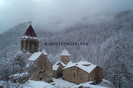
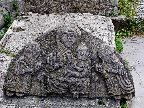
Although they attracted the attention of certain investigators at the beginning of the 20th century, they were not studied at that time. Interest in rock art monuments grew during the first decades of the 20th century, when A. Kalantar indulged himself in their study. Unfortunately, very little has been preserved from the rich material collected by him.

A. P. Deniyokhin also took part in the discovery of rock carvings in Armenia. During field studies the archaeologist S.H. Sardarian has discovered numerous rock carvings on the slopes of Aragats and the Gueghama mountains.

Over 2,000 decorated rock fragments extend to the foot of the Ughtasar mountain. Ughatasar Mountain has a crater on top that is filled with boulders covered in petroglyphs. These petroglyphs are images carved using stone tools onto dark brownish-black volcanic stones left behind by an extinct volcano.

Most images depict men in scenes of hunting and fighting, cultivating land, competing and dancing. Among the more complex carvings are what some say are among the earliest depictions of dance in the ancient world; scenes of ceremonial dance with two or more figures.

Others show figures performing, perhaps relating a famous fight or hunt, or depicting the figures as communal leaders. Other scenes are social in nature, depicting moments revolving around the central figure’s place in society, or performing ritual acts.

The number and development of the carvings suggest this field was used over thousands of years, beginning in the Paleolithic era (ca. 12,000 BCE). They are in the main considered memorials; commemorating the life and prowess of the dead. The rudimentary carvings are amazingly perceptive, recounting origin myths and tribal traditions, emotions, beliefs, defeats and victories of the ancestors.
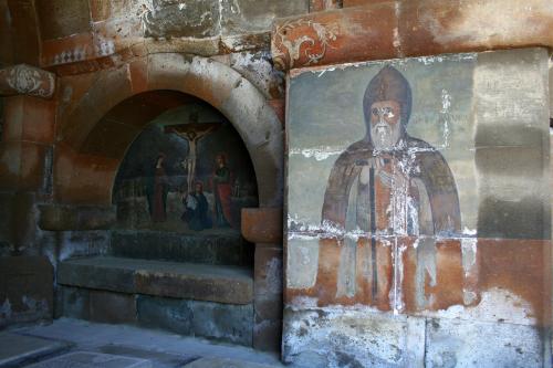
Carvings include depictions of animals (wild and domesticated aurochs urus – wild ancestors of cattle – goats, mufflon, gazelles, deer, horses, boars, wolves, dogs, jackals, leopards, bears and tigers); hunters with lassoes, traps, bows and arrows, pikes, spears and shields; carts and sleds pulled by oxen (aurochs). Cattle breeding and sheep and goat herding predominate. Interestingly, birds do not figure prominently in the Ughtasar carvings.

There are numerous cosmic symbols, including one for the zodiacal sign Aries and rudimentary calendars carved like wheels for dividing time by using a cross and four circles for the seasons. Geographic elements are also featured: rivers, lakes, springs etc., followed by astronomical bodies and phenomena: the Sun, the Moon, stars, stellar constellations and starry sky, comet, and lightning.

Later Chalcolithic and Bronze Age cultures continued to create petroglyphs at the site. People from later eras (Chalcolithic and Bronze Age) continued to record their prowess and beliefs on the stones. The largest variety and number of carvings date to this period and the early Iron Age, before it was finally abandoned except for a few carvings made by lonely shepherds spending their summers on the mountain top.

Although the site was discovered in the early 20th century, it was not really studied until the 1920s and again in the late 1960s; it is still not fully understood today. Common among them is their altitude (3,000-3,300m), their iconography and their locations near glacial lakes – which were not nearly as cold as they are now.

Spanning hundreds of kilometers of territory, the carvings («itsagir» or «goat-letters» in popular lore) found on the slopes of Ughtasar can also be found on dozens of sites in Armenia; on mountains near Tsghuk (Mets Karakhach), the Vardenis Range, and at the sources of the Yeghegis (Mt. Vardenis), Arpa (Mt. Khachatsar) and Vorotan rivers (Mt. Davagioz) to name a few.

The carvings on the rock fragments are rich with flora and fauna imagery, and depict hunting scenes, a wide array of animals, circles, spirals, dots, lines, and other geometric and abstract forms, and even zodiac signs.

Research suggests that the area served as a temporary dwelling for nomadic cattle-herding tribes, and studies of the rock carvings indicate that they were in use for hundreds of years, with peoples of later eras adding their ownengravings to the stones.

According to the research of Hamlet Martirosyan, the pictograms of Ughtasar represent a writing system known as “goat writing” or “itsagir”. Many scholars believe that this was due to the large number of goats drawn on the stones, but according to Martirosyan it is because in the ancient Armenian language, the words “goat” and “writing” were homonyms.

They would use these homonyms to express concepts through pictures, thus the abstract concept of “writing” (which in ancient Armenian can be expressed with words like “shar” – arrange, “sarel” – compile, “tsir” – a line) found its reflection in the representation of a goat (“zar”), because the words for “writing” and “goat” sounded the same.

Goats are a prevalent theme on the stones, possibly because the word “dig” in ancient Armenian meant goat and was close enough to “diq,” the ancient word for gods. By combining abstract signs with the images of animals and people in horizontal or vertical rows, prehistoric engravers were able to convey specific messages.

Reproductions of the petroglyphs, or rock engravings, of Ughtasar can be found all over Yerevan; they are inscribed onto silver jewelry, painted onto coffee cups, traced into hand-made pottery, and they adorn the walls of cafes. Reaching the petroglyphs of Ughtasar can be challenging.

Kochari

Kochari is a very well-known dance in Armenia. It is a category of dance, and each region dances it with its individual style (different moves and music). The word Kochari means “knee, come” (Koch- knee, ari-come).

John Blacking in one of his books mentioned: “Group dancing, when dancers imitate jumping goats, is known as kochari. Dancers stand abreast, holding each other’s hands, The tempo of the dance ranges from moderate to fast. Squatting and butting an imagined opponent are followed by high jumps.”

Yarkhushta

Martial dances are also very common in Armenia. One of the most popular ones is called Yarkhushta, originated from the highlands of the historical region of Sassoun in Western Armenia. It is from a category of Armenian “clap dances.”

Yarkhushta belongs to a wider category of Armenian “clap dances” (ծափ-պարեր, tsap parer). The dance is performed by men, who face each other in pairs. The key element of the dance is a forward movement when participants rapidly approach one another and vigorously clap onto the palms of hands of dancers in the opposite row.

The most important part of the dance is when dancers who are facing each other clap onto the palms of each other. Traditionally soldiers were dancing Yarkhushta before the war to feel more powerful and to awake the battle spirit in them.

Yarkhushta has traditionally been danced by Armenian soldiers before combat engagements, partly for ritualistic purposes, and partly in order to cast off fear and boost battle spirit for more effective hand-to-hand combat.

The tune of the dance is played intentionally very loudly by two zurna or p’ku (Armenian: պկու) hornpipes and one or more double-headed bass drums, each struck with a mallet and a stick from opposite sides of the drum’s cylinder.

It has been demonstrated that the combination of hornpipe’s high-frequency tone and the bass drums’ deep, low-frequency beat create a combination of sounds with wide peak-to-peak amplitude that is capable of placing the dancers in the state of euphoric trance.

This factor amplifies the effect of adrenaline/epinephrine rush that the dancing of yarkhushta usually produces. Traditionally soldiers were dancing Yarkhushta before the war to feel more powerful and to awake the battle spirit in them.

It is mentioned in the works of Movses Khorenatsi, Faustus of Byzantium, and Grigor Magistros. In modern-day Armenia, yarkhushta is popular in settlements populated by resettlers from Sassoun, especially in villages around the towns of Talin, Aparan, and Ashtarak.

The dance was popularized in the late 1930s by Srbuhi Lisitsian who taught at the Yerevan Dance College. In 1957, the dance underwent further choreographic refinement by folk culture enthusiast Vahram Aristakesian and performed by folk dance troupe from the village of Ashnak.

The dance was revived in the 1980s by the folk group Maratuk and, later, by the folk ensemble Karin. There are attempts to introduce yarkhushta into curriculum of dances and songs of the Armenian Army.

There are several poems and samples of visual art that touch on the theme of yarkhushta. Among them is the poem “Dance of Sassoun” («Սասունցիների պարը») by Gevorg Emin published in 1975. The feature films Men («Տղամարդիկ», 1972) and Yarkhushta (2004), produced by Gagik Harutyunyan.

Berd

Another well-known Armenian martial dance is called Berd. The dance originated from an old Armenian city called Vaspurakan. In the beginning, this was a game called Gmbetakhagh when people were making a fortress by standing on each other’s shoulders. After some time, the game transferred into a dance. The dancers are usually men who show the process of building a wall for the defense of territories during the battle.

Uzundara (Bride’s dance)

Uzundara or Bride’s dance is Armenian national, lyrical dance. It has originated in the valley between Agdam and Prishib villages in Karabagh. The dance reflects the fighting spirit of Armenian women and the fact that they are ready to fight with men to protect their country.

The word “Uzundara” means a long valley. It is very common to dance Uzundara during Armenian weddings, that is why very often people call it Bride’s dance. The bride either dances alone or with a group of other girls.

In the Uzundara dance, girls make various snakelike moves by using their hands and body. The reason for this is that in Armenian mythology it is said that there was a snake that had four heads each of which embodied a country.

One of his not venomous heads represented Armenia. The second one represented a friendly nation. The other two heads were poisonous and represented enemies. By making snakelike moves, women distracted the snake’s poisonous heads.

Shalakho

One of the most famous and energetic Armenian dances is called Shalakho. There are different versions of the dance, but the most spread one is where two men dance-fight to win the heart of their loved woman.

Nowadays, both men and women dance Shalakho during various events in Armenia. Women have slow and lyrical moves as in the most Armenian dances. Men’s moves are very different from women’s ones. They dance faster and more energetically.

Shavali (In-laws’ dance)

Shavali was a compulsory wedding dance in Armenia which was originated in Karno province. The dance was also called Dance of In-laws’ as either bride’s or groom’s parents danced it during the wedding.

Now the dancers of Shavali are both men and women of middle ages. If just women dance Shavali, the dance looks like “Uzundara.” The moves of the dance are exquisite and very tender.

Ververi

Ververi or Ver-ver is an Armenian group dance. The dance consists of two parts. The beginning of the song has a slow tempo. After some time, the tempo changes and gets faster. The word “Ver” in Armenian means up, and the word “Ververi” means go up and up. Previously the dance was called “Vernapar” the meaning of which is “a dance to up.”

The dancers usually were young and strong men. They were jumping very high by teaching children they needed to grow up and to be strong to protect their country. Also, in Armenian mythology, it is said that this dance would change the entire way of living for all the existing species in the world (including human beings and animals).

Posted in Uncategorized | Leave a Comment »